File:Fall River bike path.jpg

Size of this preview: 800 × 536 pixels. Other resolutions: 320 × 214 pixels | 640 × 428 pixels | 1,024 × 685 pixels | 1,280 × 857 pixels | 1,600 × 1,071 pixels.
Original file (1,600 × 1,071 pixels, file size: 793 KB, MIME type: image/jpeg)
Captions
Captions
Add a one-line explanation of what this file represents
Summary edit
| Description |
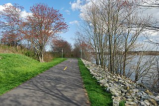
English: View of bike path along South Watuppa Pond, Fall River, Massachusetts near terminus at Westport town line. The bike path is constucted over the former Fall River and New Bedford Railroad right-of-way (later part of the Old Colony Railroad system). |
| Date | |
| Source | Own work |
| Author | Marcbela |
| Camera location | | View this and other nearby images on: OpenStreetMap |
|---|
Licensing edit
I, the copyright holder of this work, hereby publish it under the following license:
| This file is made available under the Creative Commons CC0 1.0 Universal Public Domain Dedication. | |
| The person who associated a work with this deed has dedicated the work to the public domain by waiving all of their rights to the work worldwide under copyright law, including all related and neighboring rights, to the extent allowed by law. You can copy, modify, distribute and perform the work, even for commercial purposes, all without asking permission.
|
File history
Click on a date/time to view the file as it appeared at that time.
| Date/Time | Thumbnail | Dimensions | User | Comment | |
|---|---|---|---|---|---|
| current | 14:39, 2 April 2011 | | 1,600 × 1,071 (793 KB) | Marcbela (talk | contribs) | {{Information |Description ={{en|1=View of bike path along South Watuppa Pond, Fall River, Massachusetts near terminus at Westport town line. The bike path is constucted over the former Fall River and New Bedford Railroad right-of-way (later part of th |
You cannot overwrite this file.
File usage on Commons
There are no pages that use this file.
File usage on other wikis
The following other wikis use this file:
- Usage on en.wikipedia.org