File:Farm Track - Moelfre - geograph.org.uk - 38908.jpg
Farm_Track_-_Moelfre_-_geograph.org.uk_-_38908.jpg (400 × 597 pixels, file size: 52 KB, MIME type: image/jpeg)
Captions
Captions
Summary edit
| DescriptionFarm Track - Moelfre - geograph.org.uk - 38908.jpg |
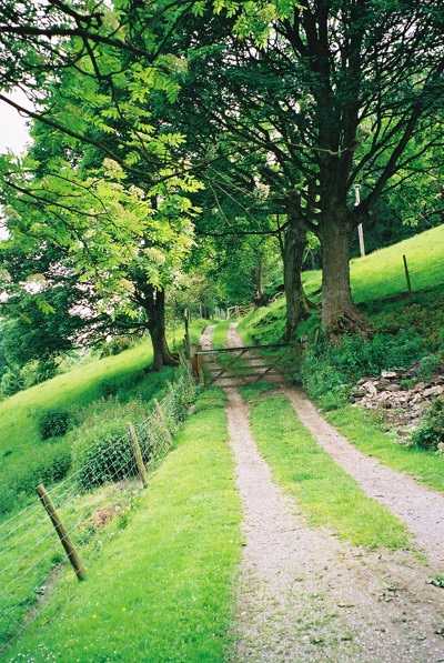
English: Farm Track - Moelfre. Billy, wake up. There's a track going up the road and it's crashed right through the gate.
Eventually leads up to the ridge of Gyrn Moelfre (The Gurn). Non-official route. The 1,715-foot (523m) mountain was the centrepiece of the Hugh Grant film "The Englishman Who Went Up a Hill But Came Down a Mountain" (Fictitious mountain : Ffynnon Garw). At under 2,000 feet, its unclear whether Gyrn Moelfre is the hill or the mountain. because in Wales, any height over 1,000 feet is considered a mountain. In most parts of the world only an elevation of over 2,000 feet is considered to be a mountain... although I'm sure someone might tackle me on this point at sometime. "Just a Map? Maps, my dear, are the undergarments of a country!" from the film "The Englishman who went up a Hill but came down a Mountain" (Miramax 1995) ... https://www.imdb.com/title/tt0112966/ The_Englishman_Who_Went_Up_a_Hill_But_Came_Down_a_Mountain The mountain where they filmed 'The Englishman who went up a hill but came down a mountain' is called Gyrn Moelfre. This is situated near the village of Llanrhaeadr-ym-Mochnant, Powys, in Mid-Wales... movie map of North Wales http://www.moviemapnw.co.uk/eng/map.html Gyrn Moelfre yw enw'r mynydd sydd i'w weld yn y ffilm 'The Englishman who went up a Hill and came down a Mountain'. Mae'r mynydd ger pentref Llanrhaeadr-ym-Mochnant, Powys, yng Nghanolbarth Cymru." ... If you're ever in this area, be sure to visit the very beautiful Pistyll Rhaeadr (the highest waterfall in Wales). But be very careful at the top, it's a long way down. You will find Pistyll Rhaeadr near the village of Llanrhaeadr-ym-Mochnant (again where "TEWWUAHBCDAM" was filmed.) ... also a spectacular NPS downhill (Mountain Biking) venue. http://www.bcf.uk.com/gallery/2005/phil/moelfre_dh/report.htm [Thrills and spills] http://www.descent-world.co.uk/ARCHIVE_PRE2005/html/race/reports/race2005/NPS2005/rnd4_moelfre.htm [More thrills and spills] http://www.descent-world.co.uk/index.php?option=com_content&Itemid=95&task=view&id=671 (check out the wing-mirror shot at the foot of the page showing the young hopefuls) This link: http://www.descent-world.co.uk/index.php?option=com_content&task=view&id=640&Itemid=95 in the Juvenile section says George Belk pulled off a creditable second place, given his age amongst the other competitors, though I know the quote by Simon Paton as having had his pants pulled down by a Scot will wind him off the end stops. Watch out for this lad in future competitions around the world. George...good luck...Uncle Simon.
|
| Date | |
| Source | From geograph.org.uk |
| Author | Simon Johnston |
| Attribution (required by the license) InfoField | Simon Johnston / Farm Track - Moelfre / |
InfoField | Simon Johnston / Farm Track - Moelfre |
| Object location | 52° 50′ 57″ N, 3° 13′ 05″ W | View this and other nearby images on: OpenStreetMap |
|---|
Licensing edit

|
This image was taken from the Geograph project collection. See this photograph's page on the Geograph website for the photographer's contact details. The copyright on this image is owned by Simon Johnston and is licensed for reuse under the Creative Commons Attribution-ShareAlike 2.0 license.
|
- You are free:
- to share – to copy, distribute and transmit the work
- to remix – to adapt the work
- Under the following conditions:
- attribution – You must give appropriate credit, provide a link to the license, and indicate if changes were made. You may do so in any reasonable manner, but not in any way that suggests the licensor endorses you or your use.
- share alike – If you remix, transform, or build upon the material, you must distribute your contributions under the same or compatible license as the original.
File history
Click on a date/time to view the file as it appeared at that time.
| Date/Time | Thumbnail | Dimensions | User | Comment | |
|---|---|---|---|---|---|
| current | 13:23, 30 January 2010 |  | 400 × 597 (52 KB) | GeographBot (talk | contribs) | == {{int:filedesc}} == {{Information |description={{en|1=Farm Track - Moelfre. Billy, wake up. There's a track going up the road and it's crashed right through the gate. Eventually leads up to the ridge of Gyrn Moelfre (The Gurn). Non-official route. |
You cannot overwrite this file.
File usage on Commons
There are no pages that use this file.
Metadata
This file contains additional information such as Exif metadata which may have been added by the digital camera, scanner, or software program used to create or digitize it. If the file has been modified from its original state, some details such as the timestamp may not fully reflect those of the original file. The timestamp is only as accurate as the clock in the camera, and it may be completely wrong.
| _error | 0 |
|---|
