File:Faurndau in D.png
Faurndau_in_D.png (141 × 177 pixels, file size: 14 KB, MIME type: image/png)
File information
Structured data
Captions
Captions
Add a one-line explanation of what this file represents
| DescriptionFaurndau in D.png |
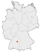
English: Map of Germany with the borders of the 16 federal states. Deutsch: Karte von Deutschland mit den Grenzen der 16 Bundesländer. |
| Date | (UTC) |
| Source | |
| Author |
|

|
Permission is granted to copy, distribute and/or modify this document under the terms of the GNU Free Documentation License, Version 1.2 or any later version published by the Free Software Foundation; with no Invariant Sections, no Front-Cover Texts, and no Back-Cover Texts. A copy of the license is included in the section entitled GNU Free Documentation License.http://www.gnu.org/copyleft/fdl.htmlGFDLGNU Free Documentation Licensetruetrue |
| This file is licensed under the Creative Commons Attribution-Share Alike 3.0 Unported license. | ||
| ||
| This licensing tag was added to this file as part of the GFDL licensing update.http://creativecommons.org/licenses/by-sa/3.0/CC BY-SA 3.0Creative Commons Attribution-Share Alike 3.0truetrue |
Original upload log edit
This image is a derivative work of the following images:
- Image:Karte_Deutschland.png licensed with GFDL-OpenGeoDB
- 2008-01-08T18:46:23Z Evilboy 188x235 (2123 Bytes) Reverted to version as of 20:35, 14 March 2007
- 2007-03-14T20:35:41Z Tene 188x235 (2123 Bytes) Optimised (0)
- 2007-02-09T11:28:58Z TM 188x235 (2414 Bytes) Contrast slightly improved without loosing precision
- 2007-01-31T19:04:32Z Notschrei 188x235 (2252 Bytes) Auf eine alte Version zurückgesetzt
- 2007-01-31T18:17:15Z Der Eberswalder 188x235 (7893 Bytes)
- 2007-01-31T12:29:27Z Geograv 188x235 (2252 Bytes) Auf eine alte Version zurückgesetzt
- 2007-01-31T11:04:32Z Der Eberswalder 188x235 (8536 Bytes) now white color outside the borders
- 2007-01-31T10:31:55Z Siebrand 188x235 (2252 Bytes) Eerdere versie hersteld
- 2007-01-31T06:31:14Z Der Eberswalder 188x235 (9463 Bytes) better viewable
- 2006-08-27T15:48:31Z TM 188x235 (2252 Bytes) Slightly error corrected version, based on [[:Image:Karte stralsund in deutschland-test.png]] by [[:de:Benutzer:Rauenstein]]
- 2005-08-23T17:25:21Z Winfried Gaenssler 188x235 (5127 Bytes) english: [[Germany]] deutsch: Deutschland {{GFDL-OpenGeoDB}} [[de:Bild:Karte Deutschland.png]] [[category:Germany]]
Uploaded with derivativeFX
File history
Click on a date/time to view the file as it appeared at that time.
| Date/Time | Thumbnail | Dimensions | User | Comment | |
|---|---|---|---|---|---|
| current | 21:05, 15 June 2008 |  | 141 × 177 (14 KB) | Tifafri~commonswiki (talk | contribs) | {{Information |Description={{en|Map of Germany with the borders of the 16 federal states.}} {{de|Karte von Deutschland mit den Grenzen der 16 Bundesländer.}} |Source=*Image:Karte_Deutschland.png |Date=2008-06-15 21:04 (UTC) |Author=*derivat |
You cannot overwrite this file.
File usage on Commons
There are no pages that use this file.
