File:Fields at Westhay - geograph.org.uk - 664718.jpg
No higher resolution available.
Fields_at_Westhay_-_geograph.org.uk_-_664718.jpg (640 × 480 pixels, file size: 65 KB, MIME type: image/jpeg)
Captions
Captions
Add a one-line explanation of what this file represents
Summary edit
| Description |
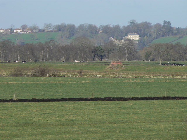
English: Fields at Westhay Across the foreground, the black line of material dredged up during ditching indicates the presence of peat in this area. The landscape is completely flat for two or three miles until the hill on which stands the prominent white house known as Castle Farm at Heath House. (The hill is locally known as the Isle of Wedmore, betraying a past when the Levels were all water.)
Invisible in this picture, the River Brue runs between embankments, approximately where the red farm vehicle and cows are. It becomes very visible in times of flood. |
| Date | |
| Source | From geograph.org.uk |
| Author | Edwin Graham |
| Attribution (required by the license) | Edwin Graham / Fields at Westhay / |
| Camera location | | View this and other nearby images on: OpenStreetMap |
|---|
_heading:0.00&language=en)
| Object location | | View this and other nearby images on: OpenStreetMap |
|---|
_heading:0.00&language=en)
Licensing edit

|
This image was taken from the Geograph project collection. See this photograph's page on the Geograph website for the photographer's contact details. The copyright on this image is owned by Edwin Graham and is licensed for reuse under the Creative Commons Attribution-ShareAlike 2.0 license.
|
This file is licensed under the Creative Commons Attribution-Share Alike 2.0 Generic license.
Attribution: Edwin Graham
- You are free:
- to share – to copy, distribute and transmit the work
- to remix – to adapt the work
- Under the following conditions:
- attribution – You must give appropriate credit, provide a link to the license, and indicate if changes were made. You may do so in any reasonable manner, but not in any way that suggests the licensor endorses you or your use.
- share alike – If you remix, transform, or build upon the material, you must distribute your contributions under the same or compatible license as the original.
- Remove redundant categories and try to put this image in the most specific category/categories
- Remove this template
- The location categories are based on information from this geonames tool and this OpenStreetMap tool combined with a database. You can also have a look at this tool from mysociety.
- The topic category from Geograph was Landscape (find similar images at Geograph)
File history
Click on a date/time to view the file as it appeared at that time.
| Date/Time | Thumbnail | Dimensions | User | Comment | |
|---|---|---|---|---|---|
| current | 18:25, 7 February 2011 | | 640 × 480 (65 KB) | GeographBot (talk | contribs) | == {{int:filedesc}} == {{Information |description={{en|1=Fields at Westhay Across the foreground, the black line of material dredged up during ditching indicates the presence of peat in this area. The landscape is completely flat for two or three miles un |
You cannot overwrite this file.
File usage on Commons
There are no pages that use this file.
File usage on other wikis
The following other wikis use this file:
- Usage on en.wikipedia.org