File:Finland ≤ 62°N 30°E.png
Size of this preview: 800 × 363 pixels. Other resolutions: 320 × 145 pixels | 847 × 384 pixels.
Original file (847 × 384 pixels, file size: 339 KB, MIME type: image/png)
Captions
Captions
Add a one-line explanation of what this file represents
Summary edit
| Description |
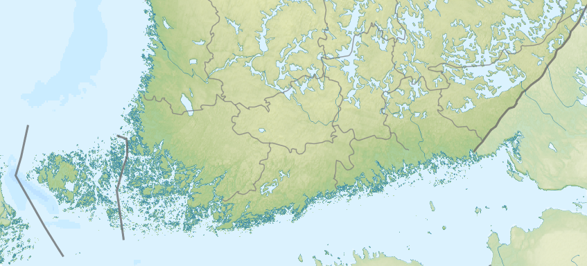
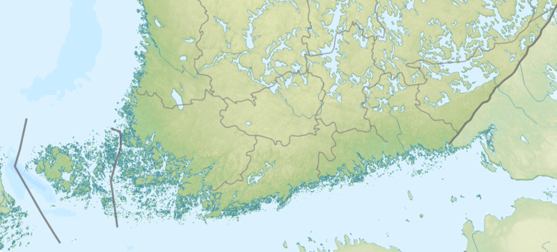
Deutsch: Positionskarte von Finnland
English: Location map of Finland
|
||||||||||||
| Date | |||||||||||||
| Source | File:Finland rel location map.png | ||||||||||||
| Author | Uwe Dedering | ||||||||||||

|
This map has been made or improved in the German Kartenwerkstatt (Map Lab). You can propose maps to improve as well.
|
Licensing edit
I, the copyright holder of this work, hereby publish it under the following license:
This file is licensed under the Creative Commons Attribution-Share Alike 4.0 International license.
- You are free:
- to share – to copy, distribute and transmit the work
- to remix – to adapt the work
- Under the following conditions:
- attribution – You must give appropriate credit, provide a link to the license, and indicate if changes were made. You may do so in any reasonable manner, but not in any way that suggests the licensor endorses you or your use.
- share alike – If you remix, transform, or build upon the material, you must distribute your contributions under the same or compatible license as the original.
File history
Click on a date/time to view the file as it appeared at that time.
| Date/Time | Thumbnail | Dimensions | User | Comment | |
|---|---|---|---|---|---|
| current | 08:50, 19 June 2018 | | 847 × 384 (339 KB) | Ulamm (talk | contribs) | {{Information |Description= {{de|1=Positionskarte von Finnland}} {{en|1=Location map of Finland}} {{Location map series N (conic)|top=70.25|longitude=25.5|latitude1=63.5|latitude2 = 66.5|bottom = 59.5}} |Source=File:Finland rel location map.png |Date=2014-10-08 |author=Uwe Dedering |Permission= |other_versions= }} {{Kartenwerkstatt}} == {{int:license-header}} == {{self|cc-by-sa-4.0}} Category:Location maps of Finland Category:Files by Uwe Dedering [[Categ... |
You cannot overwrite this file.
File usage on Commons
There are no pages that use this file.