File:Finland provincial map highlighting Ylikiiminki.png
Size of this preview: 337 × 598 pixels. Other resolutions: 135 × 240 pixels | 356 × 632 pixels.
Original file (356 × 632 pixels, file size: 126 KB, MIME type: image/png)
Captions
Captions
Add a one-line explanation of what this file represents
| Description |
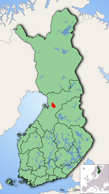
English: Location of the former municipality of Ylikiiminki, Finland, municipality on a map showing Finnish provinces.
Suomi: Kartta entisen Ylikiimingin kunnan sijainnista. |
| Source |
English: Created using a public domain map by fi-wiki user Ningyou.
Suomi: Tehty Ningyoun public domain -maakuntakarttapohjalle. |
| Author | TeVe |
| |
This work has been released into the public domain by its author, TeVe, at the English Wikipedia project. This applies worldwide. In case this is not legally possible: |
File history
Click on a date/time to view the file as it appeared at that time.
| Date/Time | Thumbnail | Dimensions | User | Comment | |
|---|---|---|---|---|---|
| current | 19:14, 7 January 2006 | | 356 × 632 (126 KB) | Joonasl (talk | contribs) | Location of ylikiiminkin. From fi-wiki: ''"Kartta Ylikiimingin kunnan sijainnista. Tehty Ningyoun public domain -maakuntakarttaphjalle."'' {{PD-user-w|fi|Finnish Wikipedia|TeVe}} Category:Maps of Finland |
You cannot overwrite this file.
File usage on Commons
There are no pages that use this file.