File:Fires in California (MODIS 2020-07-30).jpg

Original file (1,548 × 1,416 pixels, file size: 265 KB, MIME type: image/jpeg)
Captions
Captions
Summary edit
.jpg&action=edit§ion=1)
| Description |
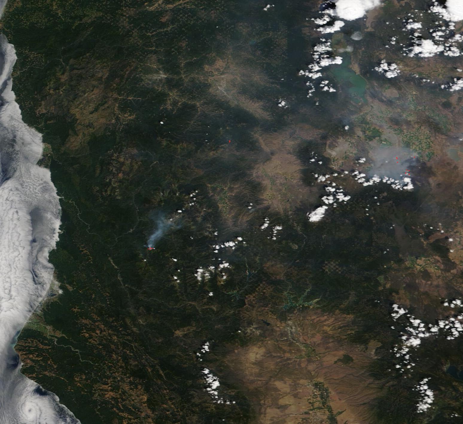
English: Smoke hung over central California while fog crept over the coast in late July 2020. The Moderate Resolution Imaging Spectroradiometer (MODIS) on board NASA’s Terra satellite acquired a true-color image of the smoky scene on July 28.
Red hot spots mark areas where the thermal bands on the instrument detected high temperatures. When combined with typical smoke, as in this image, such hot spots are diagnostic for actively burning fires. The active fires are seen in three locations, from the coast to near the Nevada border, where a several individual hot spots make up the July Complex Fire. That fire began on July 22 near Canby, California from lightning strikes. As of July 29, it had scorched 81,636 acres and the perimeter was 45 percent contained. Full containment is not expected until August 22. On July 28 another lightning strike added a new blaze to the complex, and a Red Flag Warning for dangerous fire weather is in effect on July 29. According to the CAL FIRE website, on July 29 there were 12 active fires across the state. They reported that so far in 2020 there have been 5,292 fires, which have burned approximately 78,823 acres including 36 structures. According to the website, “While wildfires are a natural part of California’s landscape, the fire season in California and across the West is starting earlier and ending later each year. Climate change is considered a key driver of this trend. Warmer spring and summer temperatures, reduced snowpack, and earlier spring snowmelt create longer and more intense dry seasons that increase moisture stress on vegetation and make forests more susceptible to severe wildfire. The length of fire season is estimated to have increased by 75 days across the Sierras and seems to correspond with an increase in the extent of forest fires across the state.” |
||
| Date | Taken on 28 July 2020 | ||
| Source |
Fires in California (direct link)
|
||
| Author | MODIS Land Rapid Response Team, NASA GSFC |
| This media is a product of the Terra mission Credit and attribution belongs to the mission team, if not already specified in the "author" row |
Licensing edit
.jpg&action=edit§ion=2)
| This file is in the public domain in the United States because it was solely created by NASA. NASA copyright policy states that "NASA material is not protected by copyright unless noted". (See Template:PD-USGov, NASA copyright policy page or JPL Image Use Policy.) | ||
 |
Warnings:
|
File history
Click on a date/time to view the file as it appeared at that time.
| Date/Time | Thumbnail | Dimensions | User | Comment | |
|---|---|---|---|---|---|
| current | 02:56, 17 February 2024 | | 1,548 × 1,416 (265 KB) | OptimusPrimeBot (talk | contribs) | #Spacemedia - Upload of http://modis.gsfc.nasa.gov/gallery/images/image07302020_250m.jpg via Commons:Spacemedia |
You cannot overwrite this file.
File usage on Commons
There are no pages that use this file.
.jpg&oldid=864853740)