File:Fires in Victoria (MODIS 2020-03-19).jpg

Original file (2,489 × 2,131 pixels, file size: 846 KB, MIME type: image/jpeg)
Captions
Captions
Summary edit
.jpg&action=edit§ion=1)
| Description |
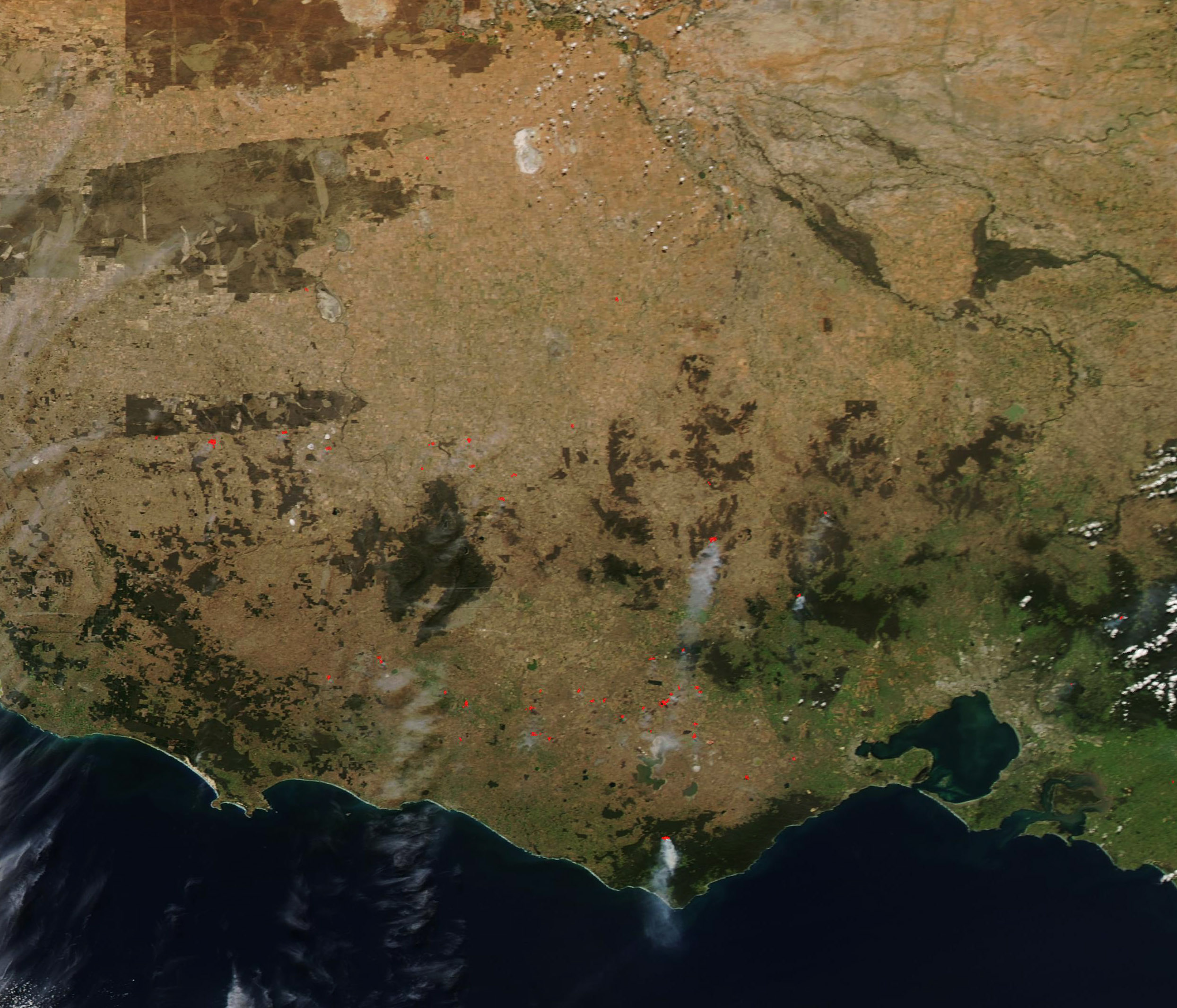
English: For much of the 2019-2020 austral summer, Victoria, Australia was ablaze with large numbers of wildfires. Thanks to soaring temperatures, dry vegetation, low humidity and gusty winds, the difficult bushfire season swept across the entire country, with New South Wales, Victoria, and Queensland hardest hit. According to the Center for Disaster Philanthropy (CDP), as of Feb. 15, 2020, more than 46 million acres (72,000 square miles) of land were burned in thousands of fires since June 2019.
Drenching rains fell in January in Victoria, with more in February. The wetter weather and the hard work of thousands of firefighters brought almost all of the fires under containment by late February. But Victoria’s bushfire season, while quiet, may not be completely over. On March 16, 2020, the Moderate Resolution Imaging Spectroradiometer (MODIS) on board NASA’s Aqua satellite acquired a true-color image of fires burning in Victoria. Each red “hot spot” marks an area where the thermal bands on the instrument detected high temperatures. When combined with typical smoke, as in this image, such hot spots are diagnostic for actively burning fire. Most of the fires appear to be burning in forested areas, with only a few in lightly vegetated, potentially agricultural areas. According to the Australian government’s VicEmergency website, the fires appear to be a mix of both planned burns, which are used to manage land, and bushfires. While most of the bushfires are contained, some are not yet under control. |
||
| Date | Taken on 16 March 2020 | ||
| Source |
Fires in Victoria (direct link)
|
||
| Author | MODIS Land Rapid Response Team, NASA GSFC |
| This media is a product of the Aqua mission Credit and attribution belongs to the mission team, if not already specified in the "author" row |
Licensing edit
.jpg&action=edit§ion=2)
| This file is in the public domain in the United States because it was solely created by NASA. NASA copyright policy states that "NASA material is not protected by copyright unless noted". (See Template:PD-USGov, NASA copyright policy page or JPL Image Use Policy.) | ||
 |
Warnings:
|
File history
Click on a date/time to view the file as it appeared at that time.
| Date/Time | Thumbnail | Dimensions | User | Comment | |
|---|---|---|---|---|---|
| current | 03:14, 17 February 2024 | | 2,489 × 2,131 (846 KB) | OptimusPrimeBot (talk | contribs) | #Spacemedia - Upload of http://modis.gsfc.nasa.gov/gallery/images/image03192020_250m.jpg via Commons:Spacemedia |
You cannot overwrite this file.
File usage on Commons
There are no pages that use this file.
.jpg&oldid=852737509)