File:First Presbyterian Church, West Innis and Jackson Streets, Salisbury, Rowan County, NC HABS NC,80-SALB,5- (sheet 7 of 29).tif

Size of this JPG preview of this TIF file: 756 × 599 pixels. Other resolutions: 303 × 240 pixels | 606 × 480 pixels | 969 × 768 pixels | 1,280 × 1,015 pixels | 2,560 × 2,029 pixels | 9,568 × 7,584 pixels.
Original file (9,568 × 7,584 pixels, file size: 651 KB, MIME type: image/tiff)
Captions
Captions
Add a one-line explanation of what this file represents
Summary edit
| HABS NC,80-SALB,5- (sheet 7 of 29) - First Presbyterian Church, West Innis and Jackson Streets, Salisbury, Rowan County, NC | ||||
|---|---|---|---|---|
| Photographer |
Related names:
|
|||
| Title |
HABS NC,80-SALB,5- (sheet 7 of 29) - First Presbyterian Church, West Innis and Jackson Streets, Salisbury, Rowan County, NC |
|||
| Depicted place | North Carolina; Rowan County; Salisbury | |||
| Date | Documentation compiled after 1933 | |||
| Dimensions | 19 x 24 in. (B size) | |||
| Current location |
Library of Congress Prints and Photographs Division Washington, D.C. 20540 USA http://hdl.loc.gov/loc.pnp/pp.print |
|||
| Accession number |
HABS NC,80-SALB,5- (sheet 7 of 29) |
|||
| Credit line |
|
|||
| Notes |
|
|||
| Source | https://www.loc.gov/pictures/item/nc0080.sheet.00007a | |||
| Permission (Reusing this file) |
|
|||
| Other versions |
.png) .png) .png) .png) .png) .png) .png) .png) .png) .png) .png) .png) .png) .png) .png) .png) .png) .png) .png) .png) .png) .png) .png) .png) .png) |
|||

| Object location | | View this and other nearby images on: OpenStreetMap |
|---|
File history
Click on a date/time to view the file as it appeared at that time.
| Date/Time | Thumbnail | Dimensions | User | Comment | |
|---|---|---|---|---|---|
| current | 21:30, 28 July 2014 | 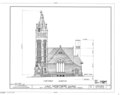 | 9,568 × 7,584 (651 KB) | Fæ (talk | contribs) | GWToolset: Creating mediafile for Fæ. HABS 24 July 2014 (2001:2300) |
You cannot overwrite this file.
File usage on Commons
The following page uses this file: