File:Fitchburg Railroad terminal on Slatter and Callan map, 1852.png
No higher resolution available.
Fitchburg_Railroad_terminal_on_Slatter_and_Callan_map,_1852.png (473 × 441 pixels, file size: 253 KB, MIME type: image/png)
Captions
Captions
Add a one-line explanation of what this file represents
Summary edit
| Description |
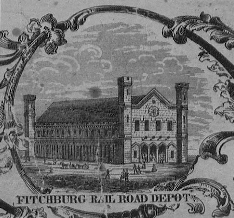
English: An inset drawing of the Fitchburg Railroad terminal on an 1852 map of Boston |
|||
| Date | ||||
| Source | Norman B. Leventhal Map Center Collection | |||
| Author | J. Slatter and B. Callan | |||
| Permission (Reusing this file) |
|


File history
Click on a date/time to view the file as it appeared at that time.
| Date/Time | Thumbnail | Dimensions | User | Comment | |
|---|---|---|---|---|---|
| current | 11:59, 13 February 2010 | | 473 × 441 (253 KB) | M2545 (talk | contribs) | {{Information |Description=Boston, ca.1852. Detail from border illustrations in J. Slatter's "Map of the city of Boston, Massts., 1852;" published by M. Dripps. |Source=Boston Public Library. http://maps.bpl.org/details_12850 |Date=1852 |Author=Slatter | |
You cannot overwrite this file.
File usage on Commons
The following page uses this file:
- File:1852 FitchburgDepot Boston map BPL 12850.png (file redirect)