File:Flag Map of The World.png

Size of this preview: 800 × 405 pixels. Other resolutions: 320 × 162 pixels | 640 × 324 pixels | 1,024 × 519 pixels | 1,280 × 648 pixels | 2,560 × 1,296 pixels | 4,974 × 2,519 pixels.
Original file (4,974 × 2,519 pixels, file size: 750 KB, MIME type: image/png)
Captions
Captions
Add a one-line explanation of what this file represents
Summary
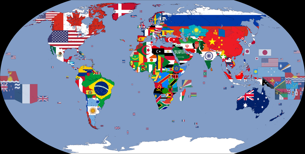
| Description |
English: A map showing the flags of the world, in equirectangular projection. The countries shown are the members of the United Nations. Western Sahara is in light grey because it is considered to be a Non-Self-Governing Territory with no (source), therefore there is no UN member state flag to represent that place.
|
| Date | |
| Source | Geography and Space |
| Author | Cookie030307 |
| Other versions |
|


.png)


.png)
.png)
.png)
| Flag maps of the world for historical use | |
|
19th Century | |
|
20th Century | |
|
1914 · 1930 · 1935 · 1937 · March 1938 · 1938 · WWII · 1962 · 1968 · 1970 · 1972 · 1974 · 1985 · 1986 · 1988 · 1989 · 1990 · 1991 · 1992 · 1993 · 1994 · 2000 | |
|
21st Century | |
|
2001 · 2002 · 2003 · 2005 · 2007 · 2008 · 2009 · 2010 · 2011 · 2012 · 2013 · 2015 · 2016 · 2017 · 2018 · 2019 · 2020 · 2021 · 2022 · 2023 · 2024 | |
|
Other Versions | |
|
Flag Map of the World · Flag Map of The World (DTI) · Flag Map of The World (DT&UCI) · Flag Map of The World (DTIN) · Flag Map of The World (DT&UCIN) | |
| (this template: • view • discuss ) | |
.png)
.png)
.png)
.png)
.png)
.png)
.png)
.png)
.png)
.png)
.png)
.png)
.png)
.png)
.png)
.png)
.png)
.png)
.png)
.png)
.png)
.png)
.png)
.png)
.png)
.png)
.png)
.png)
.png)
.png)
.png)
.png)
.png)
.png)
.png)
.png)
.png)
.png)
.png)
.png)
.png)
.png)
.png)
.png)
.png)
.png)
Licensing
This file is licensed under the Creative Commons Attribution-Share Alike 4.0 International license.
- You are free:
- to share – to copy, distribute and transmit the work
- to remix – to adapt the work
- Under the following conditions:
- attribution – You must give appropriate credit, provide a link to the license, and indicate if changes were made. You may do so in any reasonable manner, but not in any way that suggests the licensor endorses you or your use.
- share alike – If you remix, transform, or build upon the material, you must distribute your contributions under the same or compatible license as the original.
| Annotations | This image is annotated: View the annotations at Commons |
File history
Click on a date/time to view the file as it appeared at that time.
| Date/Time | Thumbnail | Dimensions | User | Comment | |
|---|---|---|---|---|---|
| current | 00:50, 7 January 2024 | | 4,974 × 2,519 (750 KB) | Cookie030307 (talk | contribs) | Updated to match current flags. |
| 08:11, 17 July 2023 |  | 4,974 × 2,519 (750 KB) | Cookie030307 (talk | contribs) | Made some changes. | |
| 13:34, 9 June 2023 |  | 4,974 × 2,519 (753 KB) | Tandreasen0421 (talk | contribs) | Reverted to version as of 22:11, 8 April 2023 (UTC). This is a better version. | |
| 16:48, 28 May 2023 |  | 4,974 × 2,519 (732 KB) | Taki2006 (talk | contribs) | Reverted to version as of 16:53, 4 April 2023 (UTC) | |
| 22:11, 8 April 2023 |  | 4,974 × 2,519 (753 KB) | Tandreasen0421 (talk | contribs) | Reverted to version as of 12:52, 31 December 2022 (UTC) | |
| 16:53, 4 April 2023 |  | 4,974 × 2,519 (732 KB) | ZakariaDjaafar (talk | contribs) | the flag of algeria | |
| 12:52, 31 December 2022 |  | 4,974 × 2,519 (753 KB) | Cookie030307 (talk | contribs) | Fixed some errors, Updated India's map and Eswatini's map. | |
| 08:58, 14 September 2022 |  | 4,974 × 2,519 (753 KB) | Cookie030307 (talk | contribs) | Removed the coat of arms on Costa Rica's map due to being looking unrealistic. | |
| 08:14, 12 September 2022 |  | 4,974 × 2,519 (753 KB) | Cookie030307 (talk | contribs) | Simplified Greenland and Svalbard's crosses, Simplified Azerbaijan's map. | |
| 11:16, 11 September 2022 |  | 4,974 × 2,519 (753 KB) | Cookie030307 (talk | contribs) | Updated Montenegro's flag map's colors to match "File:Flag of Montenegro.svg". |
You cannot overwrite this file.
File usage on Commons
The following 7 pages use this file:
- User:Cookie030307
- User:Minorax/SVG available/2021 December 25-31
- User:Minorax/SVG available/2022 January 7-12
- File:Flag Map of The World (Compact).png
- File:Flag Map of The World (dependent territories and unrecognized countries included new).png
- File:Flag Map of The World (dependent territories included new).png
- File talk:Flag Map of The World.png/Documentation