File:FlightRestrictedZones Esrange Vidsel NEAT.svg

Size of this PNG preview of this SVG file: 290 × 210 pixels. Other resolutions: 320 × 232 pixels | 640 × 463 pixels | 1,024 × 742 pixels | 1,280 × 927 pixels | 2,560 × 1,854 pixels.
Original file (SVG file, nominally 290 × 210 pixels, file size: 409 KB)
Captions
Captions
Add a one-line explanation of what this file represents
| Description |
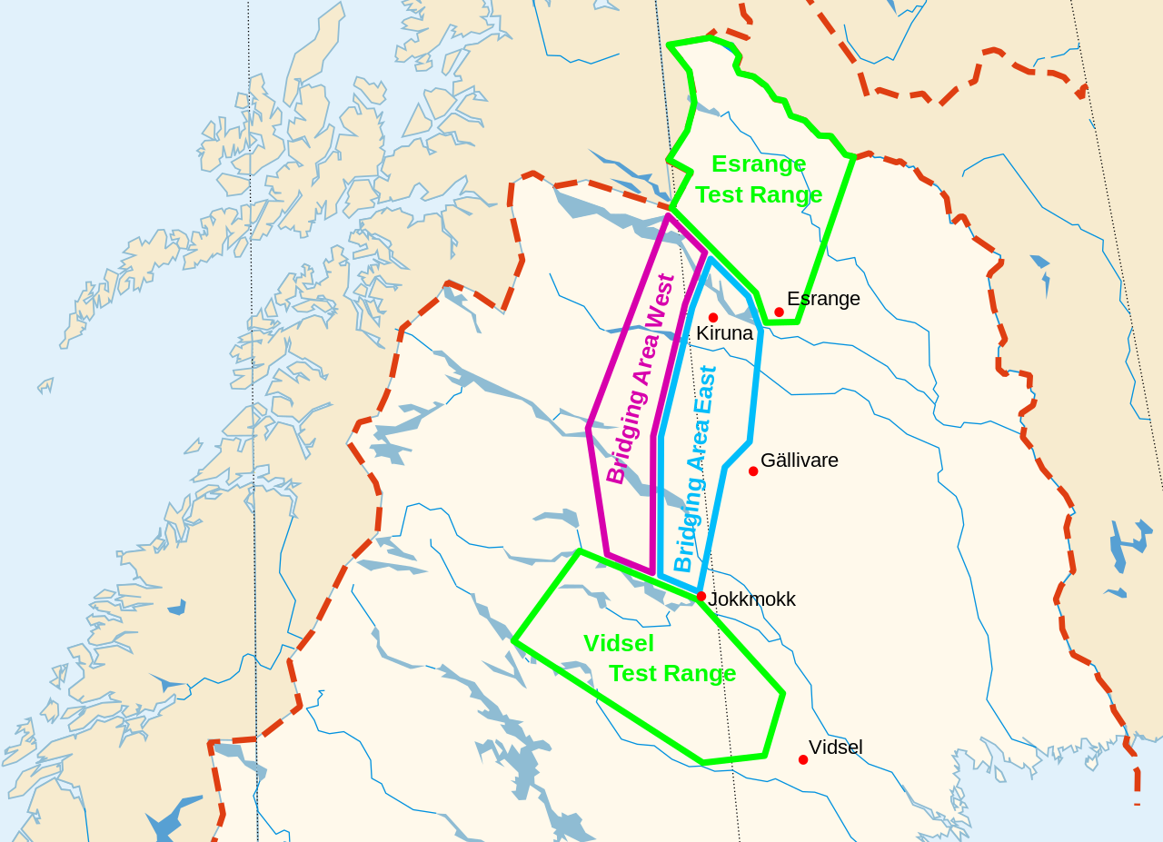
English: Flight Restricted Zones of Esrange, Vidsel Test Range and NEAT Deutsch: Kontrollierter / gesperrter Luftraum von Esrange, Vidsel Test Range und NEAT |
| Date | (UTC) |
| Source | |
| Author |
|
.svg)
I, the copyright holder of this work, hereby publish it under the following license:
| I, the copyright holder of this work, release this work into the public domain. This applies worldwide. In some countries this may not be legally possible; if so: I grant anyone the right to use this work for any purpose, without any conditions, unless such conditions are required by law. |
Original upload log edit
This image is a derivative work of the following images:
- File:Map_of_Sweden_(polar_stereographic).svg licensed with PD-self
- 2009-05-01T17:29:24Z Koyos 365x882 (443801 Bytes) colors
- 2009-05-01T16:47:01Z Koyos 365x882 (430686 Bytes) +Mälaren
- 2009-05-01T16:12:50Z Koyos 365x882 (427437 Bytes) {{Information |Description={{en|1=Map of Sweden with lakes, rivers and country borders.}} {{sv|1=Karta över Sverige med sjöar, älvar och riksgränser.}} |Source=Own work by uploader + Online Map Creation, http://www.aquari
Uploaded with derivativeFX
File history
Click on a date/time to view the file as it appeared at that time.
| Date/Time | Thumbnail | Dimensions | User | Comment | |
|---|---|---|---|---|---|
| current | 21:39, 4 March 2010 | | 290 × 210 (409 KB) | Berg2 (talk | contribs) | {{Information |Description={{en|1=Flight Restricted Zones of Esrange, Vidsel Test Range and NEAT}} {{sv|1=Kontrollierter / gesperrter Luftraum von Esrange, Vidsel Test Range und NEAT}} |Source=*File:Map_of_Sweden_(polar_stereographic).svg |Date=2010 |
You cannot overwrite this file.
File usage on Commons
The following page uses this file:
File usage on other wikis
The following other wikis use this file:
- Usage on de.wikipedia.org
- Usage on uk.wikipedia.org
- Usage on www.wikidata.org