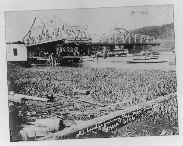
File:Floating original Ship Canal draw (in background) to University Heights location. New Ship Canal draw in foreground. June 1906 photograph. - University Heights Bridge, Spanning HAER NY,31-NEYO,178-31.tif

Size of this JPG preview of this TIF file: 750 × 600 pixels. Other resolutions: 300 × 240 pixels | 600 × 480 pixels | 960 × 768 pixels | 1,280 × 1,024 pixels | 2,560 × 2,048 pixels | 4,500 × 3,600 pixels.
Original file (4,500 × 3,600 pixels, file size: 15.45 MB, MIME type: image/tiff)
Captions
Captions
Add a one-line explanation of what this file represents
Summary edit
| Title |
Floating original Ship Canal draw (in background) to University Heights location. New Ship Canal draw in foreground. June 1906 photograph. - University Heights Bridge, Spanning Harlem River at 207th Street and West Harlem Road, New York, New York County, NY |
|||
| Depicted place | New York; New York County; New York | |||
| Date | Documentation compiled after 1968 | |||
| Dimensions | 8 x 10 in. | |||
| Current location |
Library of Congress Prints and Photographs Division Washington, D.C. 20540 USA http://hdl.loc.gov/loc.pnp/pp.print |
|||
| Accession number |
HAER NY,31-NEYO,178-31 |
|||
| Credit line |
|
|||
| Notes |
|
|||
| Source | https://www.loc.gov/pictures/item/ny1596.photos.349948p | |||
| Permission (Reusing this file) |
|

| Camera location | | View this and other nearby images on: OpenStreetMap |
|---|
File history
Click on a date/time to view the file as it appeared at that time.
| Date/Time | Thumbnail | Dimensions | User | Comment | |
|---|---|---|---|---|---|
| current | 20:01, 27 May 2021 |  | 4,500 × 3,600 (15.45 MB) | User-duck (talk | contribs) | Cropped excess border using CropTool with lossless mode. |
| 19:38, 29 July 2014 |  | 5,000 × 3,956 (18.87 MB) | Fæ (talk | contribs) | GWToolset: Creating mediafile for Fæ. HABS 24 July 2014 (2301:2600) |
You cannot overwrite this file.
File usage on Commons
The following 2 pages use this file:
File usage on other wikis
The following other wikis use this file:
- Usage on en.wikipedia.org