File:Floor plan of Lalitankura Pallavesvara Griham, Upper Cave Tiruchirappalli, Tamil Nadu.jpg

Size of this preview: 800 × 518 pixels. Other resolutions: 320 × 207 pixels | 640 × 414 pixels | 1,024 × 663 pixels | 1,280 × 828 pixels | 2,560 × 1,656 pixels | 5,100 × 3,300 pixels.
Original file (5,100 × 3,300 pixels, file size: 688 KB, MIME type: image/jpeg)
Captions
Captions
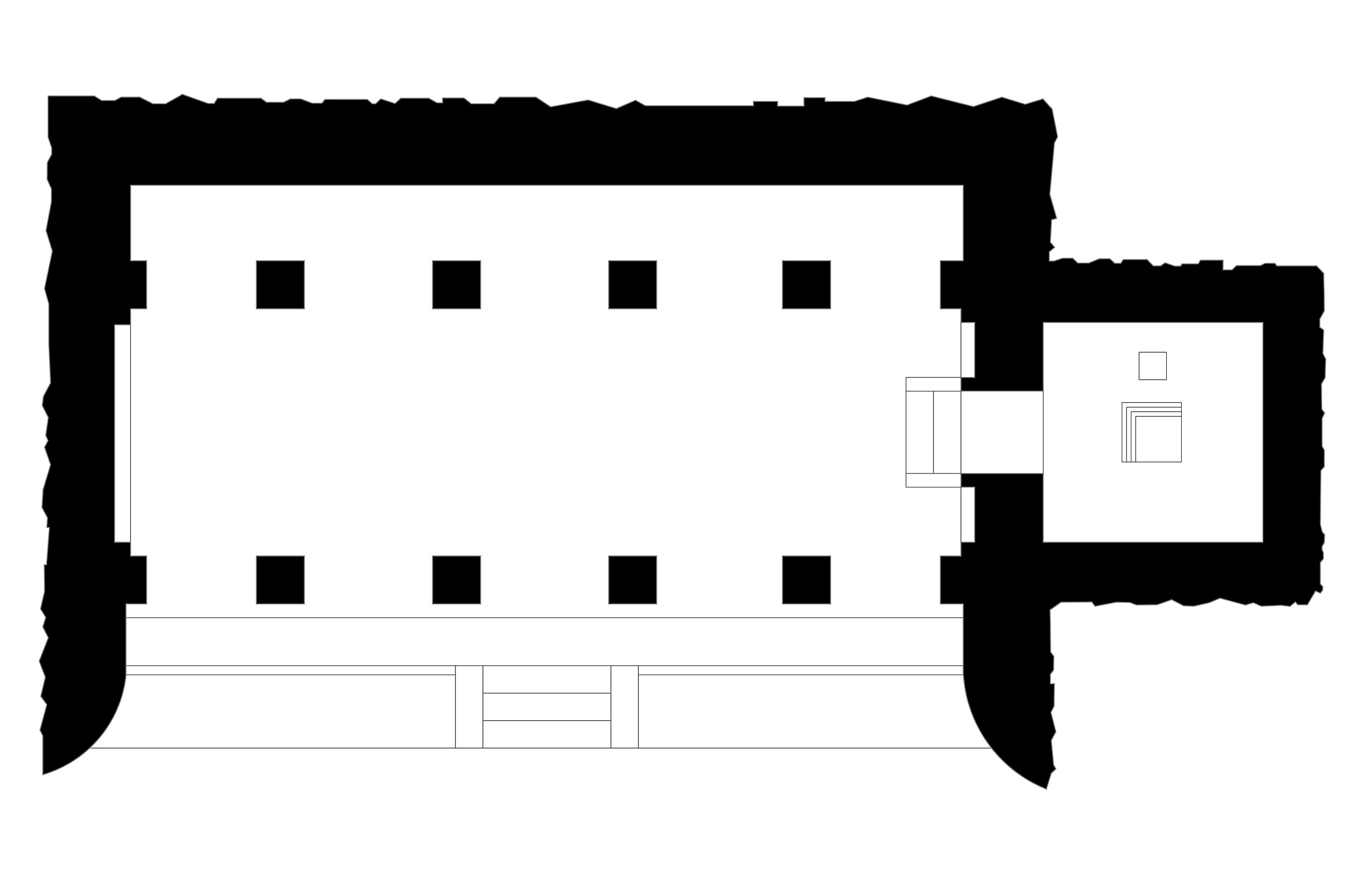
An early 7th-century Pallava-era Hindu cave temple in Trichy, with important and controversial Sanskrit inscriptions
Summary edit
| Description |
English: This is a JPEG format plan and architectural drawing of a historic Indian temple or monument. An alternate SVG format (scalable vector graphics) version of this file – for web graphics, design studies, print, dynamic and interactive applications – has also been uploaded to wikimedia commons.
The drawing:
|
|||
| Date | ||||
| Source | Own work | |||
| Author | Ms Sarah Welch |
Licensing edit
I, the copyright holder of this work, hereby publish it under the following license:
| This file is made available under the Creative Commons CC0 1.0 Universal Public Domain Dedication. | |
| The person who associated a work with this deed has dedicated the work to the public domain by waiving all of their rights to the work worldwide under copyright law, including all related and neighboring rights, to the extent allowed by law. You can copy, modify, distribute and perform the work, even for commercial purposes, all without asking permission.
|
File history
Click on a date/time to view the file as it appeared at that time.
| Date/Time | Thumbnail | Dimensions | User | Comment | |
|---|---|---|---|---|---|
| current | 17:03, 7 September 2021 | | 5,100 × 3,300 (688 KB) | Ms Sarah Welch (talk | contribs) | Uploaded own work with UploadWizard |
You cannot overwrite this file.
File usage on Commons
There are no pages that use this file.