File:Flugplatz Oberpfaffenhofen Aerial.jpg
Size of this preview: 450 × 600 pixels. Other resolutions: 180 × 240 pixels | 558 × 744 pixels.
Original file (558 × 744 pixels, file size: 146 KB, MIME type: image/jpeg)
Captions
Captions
Add a one-line explanation of what this file represents
Summary edit
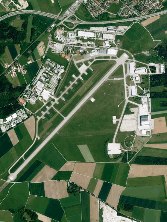
| Description | Luftaufnahme der Bayerischen Vermessungsverwaltung: Flugplatz Oberpfaffenhofen bei Weßling, Landkreis Starnberg, Bayern. |
| Date | |
| Source | http://vermessung.bayern.de/opendata |
| Author | Bayerische Vermessungsverwaltung – www.geodaten.bayern.de |
| Permission (Reusing this file) |
CC BY 3.0 DE |
Licensing edit
This file is licensed under the Creative Commons Attribution 3.0 Unported license.
- You are free:
- to share – to copy, distribute and transmit the work
- to remix – to adapt the work
- Under the following conditions:
- attribution – You must give appropriate credit, provide a link to the license, and indicate if changes were made. You may do so in any reasonable manner, but not in any way that suggests the licensor endorses you or your use.
File history
Click on a date/time to view the file as it appeared at that time.
| Date/Time | Thumbnail | Dimensions | User | Comment | |
|---|---|---|---|---|---|
| current | 18:45, 30 April 2013 | | 558 × 744 (146 KB) | Rudolph Buch (talk | contribs) |
You cannot overwrite this file.
File usage on Commons
The following page uses this file:
File usage on other wikis
The following other wikis use this file:
- Usage on de.wikipedia.org
- Usage on en.wikipedia.org
- Usage on ro.wikipedia.org