File:Fogama'a Crater.jpg
No higher resolution available.
Fogama'a_Crater.jpg (300 × 225 pixels, file size: 30 KB, MIME type: image/jpeg)
Captions
Captions
Add a one-line explanation of what this file represents
Summary edit
| Camera location | | View this and other nearby images on: OpenStreetMap |
|---|
| Description |
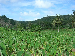
English: Fogama'a Crater National Natural Landmark, Tutuila, American Samoa |
| Date | Unknown date |
| Source | http://www.nature.nps.gov/nnl/site.cfm?Site=FOCR-AS |
| Author | Unknown author |
Licensing edit
| This image or media file contains material based on a work of a National Park Service employee, created as part of that person's official duties. As a work of the U.S. federal government, such work is in the public domain in the United States. See the NPS website and NPS copyright policy for more information. |
File history
Click on a date/time to view the file as it appeared at that time.
| Date/Time | Thumbnail | Dimensions | User | Comment | |
|---|---|---|---|---|---|
| current | 15:43, 19 March 2012 | | 300 × 225 (30 KB) | Deor (talk | contribs) |
You cannot overwrite this file.
File usage on Commons
There are no pages that use this file.
File usage on other wikis
The following other wikis use this file:
- Usage on ceb.wikipedia.org
- Usage on en.wikipedia.org
- Usage on it.wikipedia.org
- Usage on pl.wikipedia.org
- Usage on sm.wikipedia.org
- Usage on www.wikidata.org