File:FolgefonnaSatelliteImage.jpg
Size of this preview: 491 × 599 pixels. Other resolutions: 197 × 240 pixels | 393 × 480 pixels | 700 × 854 pixels.
Original file (700 × 854 pixels, file size: 360 KB, MIME type: image/jpeg)
Captions
Captions
Add a one-line explanation of what this file represents
| Description | |
| Date | Unknown date |
| Source | NASA World Wind screenshot (i-cubed landsat imagery) |
| Author | NASA/University of Maryland (edited by Aqwis) |
| This image is in the public domain because it is a screenshot from NASA’s globe software World Wind using a public domain layer, such as Blue Marble, MODIS, Landsat, SRTM, USGS or GLOBE.
|
 |
File history
Click on a date/time to view the file as it appeared at that time.
| Date/Time | Thumbnail | Dimensions | User | Comment | |
|---|---|---|---|---|---|
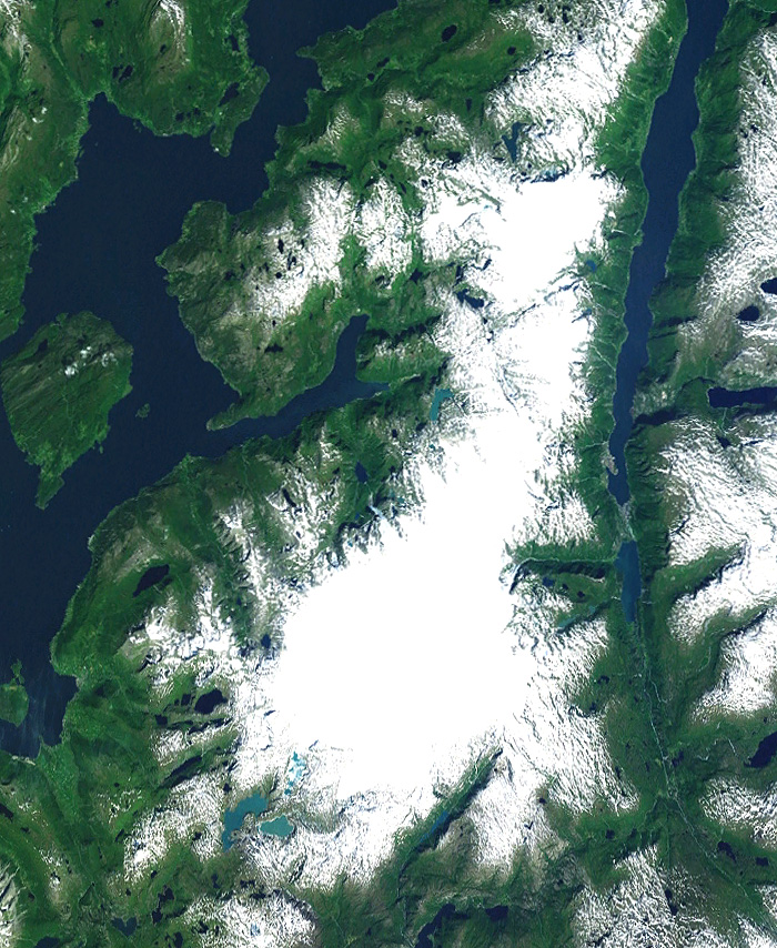
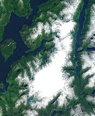
| current | 23:22, 29 December 2008 | | 700 × 854 (360 KB) | Aqwis (talk | contribs) | {{Information |Description={{en|Satellite image of the Folgefonna glaciers in Hordaland county, Norway.}} |Source=NASA World Wind screenshot (i-cubed landsat imagery) |Date=Unknown. |Author=NASA/University of Maryland (edited by |
You cannot overwrite this file.
File usage on Commons
The following page uses this file:
File usage on other wikis
The following other wikis use this file:
- Usage on de.wikipedia.org
- Usage on it.wikipedia.org
- Usage on no.wikipedia.org