File:Fonseca gulf.jpg

Size of this preview: 615 × 600 pixels. Other resolutions: 246 × 240 pixels | 492 × 480 pixels | 640 × 624 pixels.
Original file (640 × 624 pixels, file size: 109 KB, MIME type: image/jpeg)
Captions
Captions
Add a one-line explanation of what this file represents
Summary edit
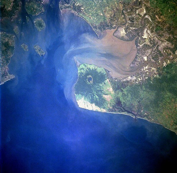
| Description |
Gulf of Fonseca, El Salvador, Honduras, Nicaragua |
| Date | |
| Source | eol.jsc.nasa.gov |
| Author | NASA |
| Other versions |
.jpg)
Licensing edit
| This file is in the public domain in the United States because it was solely created by NASA. NASA copyright policy states that "NASA material is not protected by copyright unless noted". (See Template:PD-USGov, NASA copyright policy page or JPL Image Use Policy.) | ||
 |
Warnings:
|
File history
Click on a date/time to view the file as it appeared at that time.
| Date/Time | Thumbnail | Dimensions | User | Comment | |
|---|---|---|---|---|---|
| current | 09:40, 22 November 2022 | | 640 × 624 (109 KB) | SteinsplitterBot (talk | contribs) | Bot: Image rotated by 270° |
| 04:10, 10 December 2005 |  | 631 × 640 (110 KB) | Thuresson (talk | contribs) | Gulf of Fonseca, El Salvador, Honduras, Nicaragua - July 1997 *Image courtesy of the Image Science & Analysis Laboratory, NASA Johnson Space Center. *Source: [http://eol.jsc.nasa.gov/sseop/EFS/photoinfo.pl?PHOTO=STS094-723-83 eol.jsc.nasa.gov] *Photo #: |
You cannot overwrite this file.
File usage on Commons
The following 2 pages use this file:
File usage on other wikis
The following other wikis use this file:
- Usage on de.wikipedia.org
- Usage on el.wikipedia.org
- Usage on en.wikipedia.org
- Usage on eo.wikipedia.org
- Usage on es.wikipedia.org
- Usage on fr.wikipedia.org
- Usage on gl.wikipedia.org
- Usage on it.wikipedia.org
- Usage on ja.wikipedia.org
- Usage on lt.wikipedia.org
- Usage on nl.wikipedia.org
- Usage on pl.wikipedia.org
- Usage on pt.wikipedia.org
- Usage on ru.wikipedia.org
- Usage on sk.wikipedia.org
- Usage on uk.wikipedia.org
- Usage on www.wikidata.org