File:Former railway now road - geograph.org.uk - 671772.jpg
Size of this preview: 450 × 600 pixels. Other resolutions: 180 × 240 pixels | 480 × 640 pixels.
Original file (480 × 640 pixels, file size: 114 KB, MIME type: image/jpeg)
Captions
Captions
Add a one-line explanation of what this file represents
Summary edit
| Description |
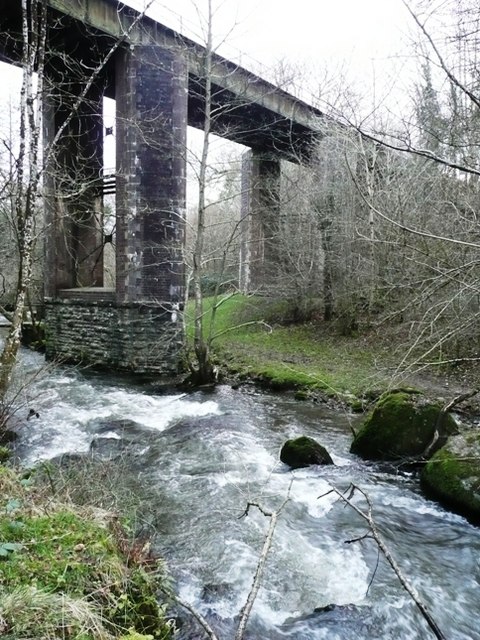
English: Former railway now road. This bridge carried the former Boughrood to Builth Wells railway line over this unnamed stream that flows into the river Wye just 200 yards beyond. After the closure of the railway in 1963 the railway was converted into a road which crosses this bridge. The top is seen here 239215 |
| Date | |
| Source | From geograph.org.uk |
| Author | Graham Horn |
| Attribution (required by the license) | Graham Horn / Former railway now road / |
| Camera location | | View this and other nearby images on: OpenStreetMap |
|---|
_heading:270.00&language=en)
| Object location | | View this and other nearby images on: OpenStreetMap |
|---|
_heading:270.00&language=en)
Licensing edit

|
This image was taken from the Geograph project collection. See this photograph's page on the Geograph website for the photographer's contact details. The copyright on this image is owned by Graham Horn and is licensed for reuse under the Creative Commons Attribution-ShareAlike 2.0 license.
|
This file is licensed under the Creative Commons Attribution-Share Alike 2.0 Generic license.
Attribution: Graham Horn
- You are free:
- to share – to copy, distribute and transmit the work
- to remix – to adapt the work
- Under the following conditions:
- attribution – You must give appropriate credit, provide a link to the license, and indicate if changes were made. You may do so in any reasonable manner, but not in any way that suggests the licensor endorses you or your use.
- share alike – If you remix, transform, or build upon the material, you must distribute your contributions under the same or compatible license as the original.
File history
Click on a date/time to view the file as it appeared at that time.
| Date/Time | Thumbnail | Dimensions | User | Comment | |
|---|---|---|---|---|---|
| current | 22:10, 7 February 2011 | | 480 × 640 (114 KB) | GeographBot (talk | contribs) | == {{int:filedesc}} == {{Information |description={{en|1=Former railway now road This bridge carried the former Boughrood to Builth Wells railway line over this unnamed stream that flows into the river Wye just 200 yards beyond. After the closure of the |
You cannot overwrite this file.
File usage on Commons
There are no pages that use this file.