File:FortMacon.jpg
Size of this preview: 800 × 600 pixels. Other resolutions: 320 × 240 pixels | 640 × 480 pixels | 1,024 × 767 pixels | 1,280 × 959 pixels | 2,339 × 1,753 pixels.
Original file (2,339 × 1,753 pixels, file size: 943 KB, MIME type: image/jpeg)
Captions
Captions
Add a one-line explanation of what this file represents
Summary edit
| Description |
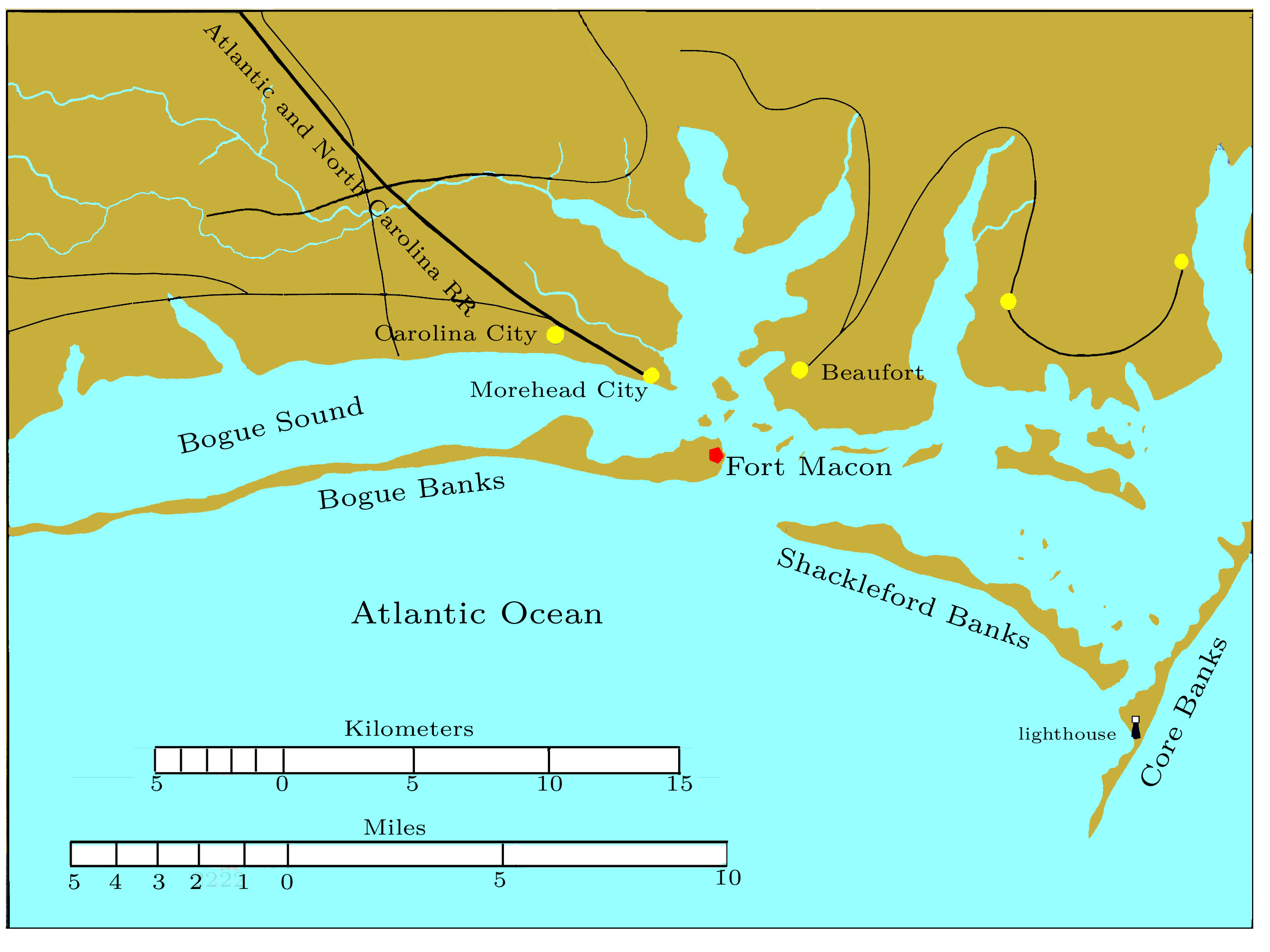
English: North Carolina coast in the vicinity of Fort Macon, showing its relation to Carolina City, Morehead City, and Beaufort. |
| Date | |
| Source | Own work |
| Author | self |
The map is my reworking of a map prepared by Major General J. G. Foster to accompany his report to the Congressional Committee on the Conduct of the [American Civil] War. The original, being the work of a person employed by the US government, is not subject to copyright. See the Official military atlas of the Civil War, Plate 40-4.
Licensing edit
| I, the copyright holder of this work, release this work into the public domain. This applies worldwide. In some countries this may not be legally possible; if so: I grant anyone the right to use this work for any purpose, without any conditions, unless such conditions are required by law. |
File history
Click on a date/time to view the file as it appeared at that time.
| Date/Time | Thumbnail | Dimensions | User | Comment | |
|---|---|---|---|---|---|
| current | 14:29, 1 October 2009 | | 2,339 × 1,753 (943 KB) | Pkkphysicist (talk | contribs) | {{Information |Description={{en|1=North Carolina coast in the vicinity of Fort Macon, showing its relation to Carolina City, Morehead City, and Beaufort.}} |Source=Own work |Author=self |Date=2009-10-01 |Permission= |other_versions= }} The map is my rewor |
You cannot overwrite this file.
File usage on Commons
There are no pages that use this file.
File usage on other wikis
The following other wikis use this file:
- Usage on en.wikipedia.org
- Usage on fr.wikipedia.org