File:Fort St. Clair site overview.jpg

Size of this preview: 800 × 600 pixels. Other resolutions: 320 × 240 pixels | 640 × 480 pixels | 1,024 × 768 pixels | 1,280 × 960 pixels | 2,560 × 1,920 pixels | 2,816 × 2,112 pixels.
Original file (2,816 × 2,112 pixels, file size: 2.81 MB, MIME type: image/jpeg)
Captions
Captions
Add a one-line explanation of what this file represents
|
This is an image of a place or building that is listed on the National Register of Historic Places in the United States of America. Its reference number is 70000514. |
| Camera location | | View this and other nearby images on: OpenStreetMap |
|---|
| Description |
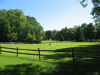
English: Fields at the site of Fort St. Clair, located on the western edge of Eaton, Ohio, United States. Built in 1792 during the Northwest Indian War under the direction of Arthur St. Clair, the fort was a supply depot. Today, the fort site (formerly a state park) is listed on the National Register of Historic Places. |
||
| Date | Taken on 16 August 2010 | ||
| Source | Own work | ||
| Author | Nyttend | ||
| Permission (Reusing this file) |
|
File history
Click on a date/time to view the file as it appeared at that time.
| Date/Time | Thumbnail | Dimensions | User | Comment | |
|---|---|---|---|---|---|
| current | 19:42, 18 August 2010 | | 2,816 × 2,112 (2.81 MB) | Nyttend (talk | contribs) | {{Location|39|44|16|N|84|39|15|W}} {{Information |Description={{en|Fields at the site of {{w|Fort St. Clair}}, located on the western edge of {{w|Eaton, Ohio|Eaton}}, {{w|Ohio}}, {{w|United States}}. Built in 1792 during the {{w|Northwest Indian War}} un |
You cannot overwrite this file.
File usage on Commons
There are no pages that use this file.
File usage on other wikis
The following other wikis use this file:
- Usage on en.wikipedia.org
- Usage on fr.wikipedia.org
- Usage on www.wikidata.org