File:Fort saint-jean, tour du fanal.jpg
Size of this preview: 450 × 600 pixels. Other resolutions: 180 × 240 pixels | 360 × 480 pixels | 576 × 768 pixels | 768 × 1,024 pixels | 2,448 × 3,264 pixels.
Original file (2,448 × 3,264 pixels, file size: 2.81 MB, MIME type: image/jpeg)
Captions
Captions
Add a one-line explanation of what this file represents
Summary edit
| Description |
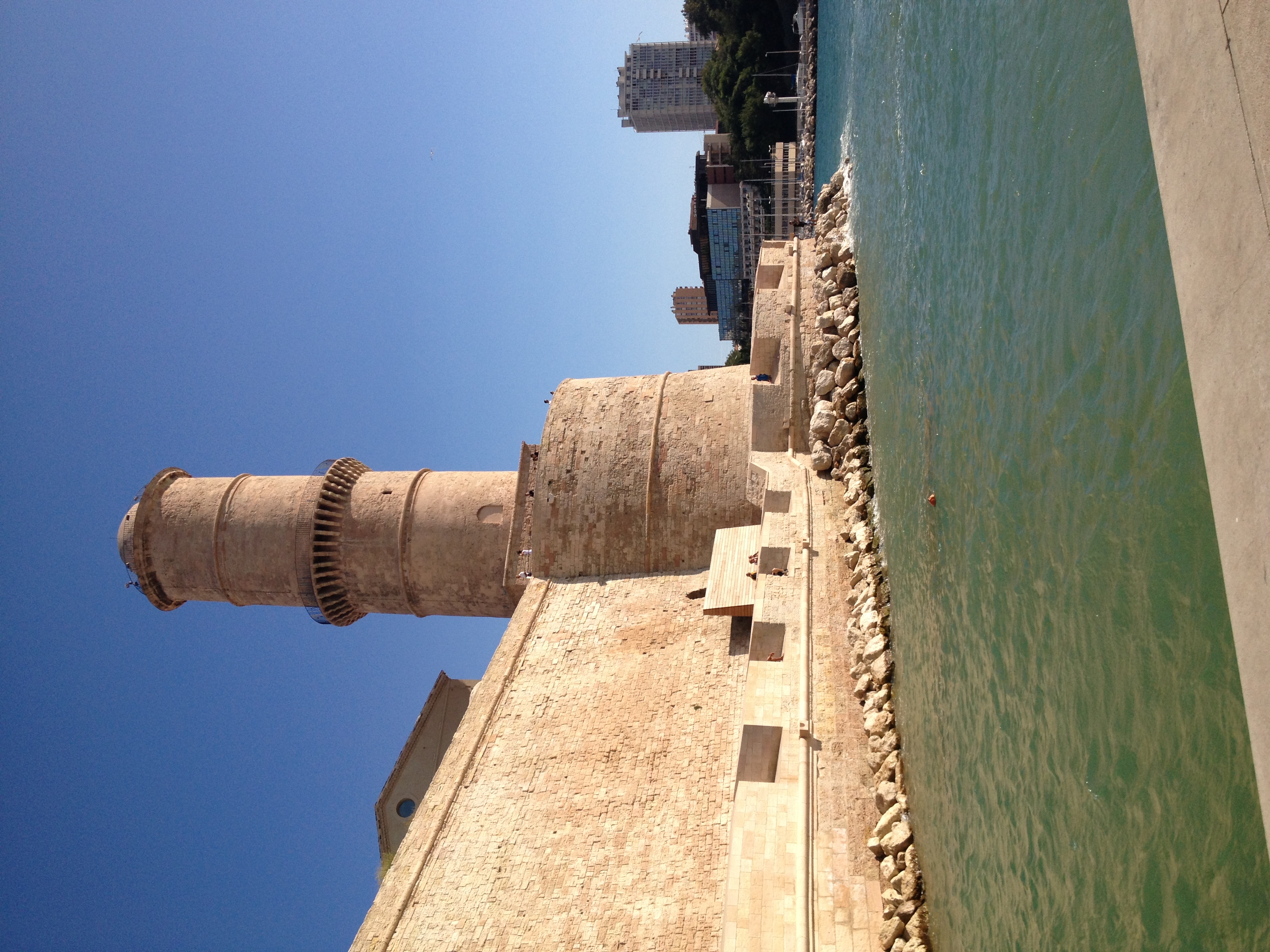
Classé monument historique depuis 1964 Le fort Saint-Jean doit son nom à la commanderie des Hospitaliers de Saint-Jean de Jérusalem . À cet emplacement, des vestiges de la toute première occupation grecque au vie siècle av. J.-C. ont été découverts. Au milieu du XVIIe, les armateurs marseillais veulent fortifier l’ensemble par une tour de vigie, suffisamment haute pour être visible des navires de commerce à plus de 20Km de la rade de Marseille. On fait alors construire la "Tour du Fanal" ou Tour Ronde. |
| Date | 25 August 2013 (according to Exif data) |
| Source | Own work |
| Author | User:mikaelyves |
| Camera location | | View this and other nearby images on: OpenStreetMap |
|---|
Licensing edit
I, the copyright holder of this work, hereby publish it under the following license:
This file is licensed under the Creative Commons Attribution-Share Alike 3.0 Unported license.
- You are free:
- to share – to copy, distribute and transmit the work
- to remix – to adapt the work
- Under the following conditions:
- attribution – You must give appropriate credit, provide a link to the license, and indicate if changes were made. You may do so in any reasonable manner, but not in any way that suggests the licensor endorses you or your use.
- share alike – If you remix, transform, or build upon the material, you must distribute your contributions under the same or compatible license as the original.
| This file was uploaded via Mobile iOS 1.0.8. |
File history
Click on a date/time to view the file as it appeared at that time.
| Date/Time | Thumbnail | Dimensions | User | Comment | |
|---|---|---|---|---|---|
| current | 18:42, 3 September 2013 | | 2,448 × 3,264 (2.81 MB) | Mikaelyves (talk | contribs) | Uploaded with Commons for iOS |
You cannot overwrite this file.
File usage on Commons
There are no pages that use this file.