File:Frankfurt Altstadt-Position-Scharnhaeuser-Ravenstein1861.jpg
Original file (1,200 × 800 pixels, file size: 755 KB, MIME type: image/jpeg)
Captions
Captions
Summary edit
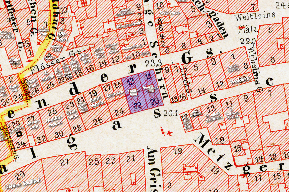
Scharnhäuser zwischen Bendergasse und Saalgasse im baulichen Umfeld. Ausschnitt aus dem Ravenstein-Plan Frankfurts aus dem Jahr 1862. Chromolithographie, gescannt und digital nachbearbeitet, das Gebäude wurde farblich hervorgehoben.
Da der Plan auf nicht säurefreien Papier gedruckt wurde, sind trotz Nachbearbeitung die Zeichen deutlicher Alterungsspuren zu sehen. Nichtsdestotrotz handelt es sich bei dem Plan um das wohl genaueste Kartenwerk Frankfurts im ganzen 19. Jahrhundert.
Der Plan steht unter der GFDL-Lizenz und ist somit gemeinfrei.
Licensing edit

|
Permission is granted to copy, distribute and/or modify this document under the terms of the GNU Free Documentation License, Version 1.2 or any later version published by the Free Software Foundation; with no Invariant Sections, no Front-Cover Texts, and no Back-Cover Texts. A copy of the license is included in the section entitled GNU Free Documentation License. |
| This file is licensed under the Creative Commons Attribution-Share Alike 3.0 Unported license. | ||
| ||
| This licensing tag was added to this file as part of the GFDL licensing update. |
File history
Click on a date/time to view the file as it appeared at that time.
| Date/Time | Thumbnail | Dimensions | User | Comment | |
|---|---|---|---|---|---|
| current | 16:13, 19 January 2008 | | 1,200 × 800 (755 KB) | Mylius (talk | contribs) | ''Scharnhäuser'' zwischen ''Bendergasse'' und ''Saalgasse'' im baulichen Umfeld. Ausschnitt aus dem Ravenstein-Plan Frankfurts aus dem Jahr 1862. Chromolithographie, gescannt und digital nachbearbeitet, das Gebäude wurde farblich hervorgehoben. Da der |
You cannot overwrite this file.
File usage on Commons
The following 2 pages use this file:
File usage on other wikis
The following other wikis use this file:
- Usage on de.wikipedia.org