File:Freising (USAAF 1945-04-25).png

Size of this preview: 603 × 600 pixels. Other resolutions: 241 × 240 pixels | 482 × 480 pixels | 772 × 768 pixels | 1,029 × 1,024 pixels | 2,058 × 2,048 pixels | 4,186 × 4,165 pixels.
Original file (4,186 × 4,165 pixels, file size: 22.04 MB, MIME type: image/png)
Captions
Captions
Add a one-line explanation of what this file represents
| Description |
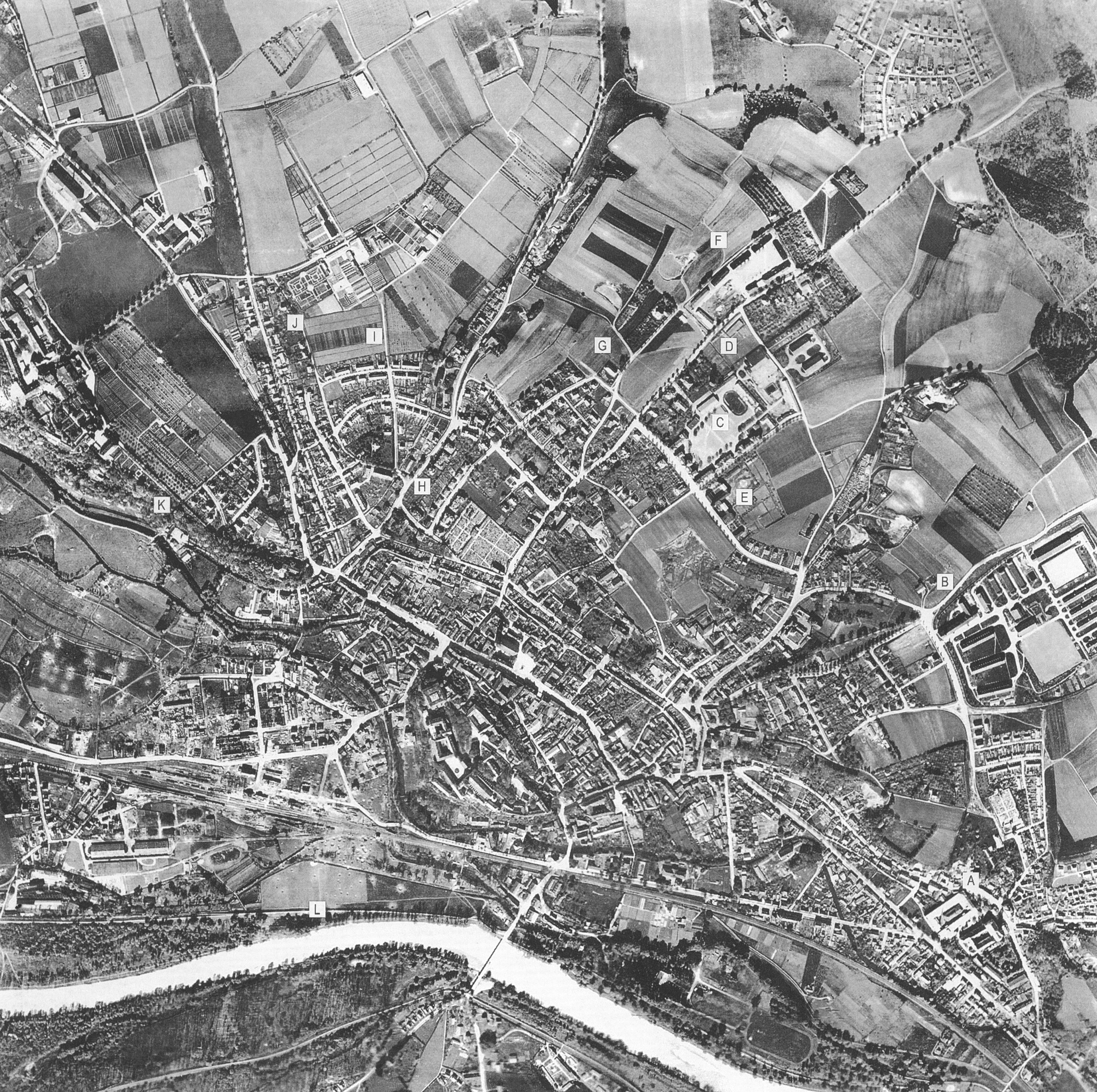
English: Post attack aerial picture of Freising, Bavaria, attack on 18 April 1945 Deutsch: Luftaufnahme von Freising nach dem Luftangriff vom 18. April 1945 |
| Date | |
| Source | Britta von Rettberg: Freising-Stadttopographie und Denkmalpflege. Imhof, Petersberg 2009, ISBN 978-3865683540 |
| Author | USAAF |
| Camera location | | View this and other nearby images on: OpenStreetMap |
|---|
.png¶ms=048.402255_N_0011.741327_E_globe:Earth_type:camera_region:DE-BY_&language=en)
This file is a work of a U.S. Army soldier or employee, taken or made as part of that person's official duties. As a work of the U.S. federal government, it is in the public domain in the United States.
|
 |
File history
Click on a date/time to view the file as it appeared at that time.
| Date/Time | Thumbnail | Dimensions | User | Comment | |
|---|---|---|---|---|---|
| current | 18:00, 11 January 2013 | | 4,186 × 4,165 (22.04 MB) | Vuxi (talk | contribs) | {{Information |Description= {{en|Post attack aerial picture of Freising, Bavaria, attack on 18 April 1945}} {{de|Luftaufnahme von Freising nach dem Luftangriff vom 18. April 1945}} |Source= Britta von Rettberg: Freisin... |
You cannot overwrite this file.
File usage on Commons
The following page uses this file:
File usage on other wikis
The following other wikis use this file:
- Usage on de.wikipedia.org
- Usage on fr.wikipedia.org
.png&oldid=529663705)