File:Frontiers of France (1521).jpg
Size of this preview: 460 × 599 pixels. Other resolutions: 184 × 240 pixels | 368 × 480 pixels | 590 × 768 pixels | 786 × 1,024 pixels | 1,680 × 2,188 pixels.
Original file (1,680 × 2,188 pixels, file size: 1.32 MB, MIME type: image/jpeg)
Captions
Captions
Add a one-line explanation of what this file represents
Summary edit
.jpg&action=edit§ion=1)
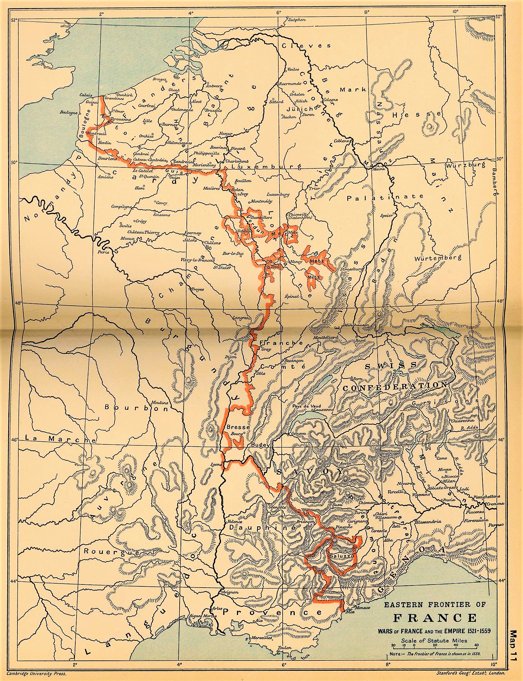
| Description | Eastern frontiers of France for the period 1521–59; line shown is the 1559 border. | |||||
| Date | ||||||
| Source | The Cambridge Modern History Atlas (1912) via the Perry-Castañeda Library Map Collection at the University of Texas. | |||||
| Author | Sir Adolphus William Ward, G.W. Prothero, Sir Stanley Mordaunt Leathes, and E.A. Benians (eds.) | |||||
| Permission (Reusing this file) |
|
|||||
File history
Click on a date/time to view the file as it appeared at that time.
| Date/Time | Thumbnail | Dimensions | User | Comment | |
|---|---|---|---|---|---|
| current | 14:51, 1 December 2021 | | 1,680 × 2,188 (1.32 MB) | Amitchell125 (talk | contribs) | quality enhanced slightly |
| 14:47, 1 December 2021 |  | 561 × 502 (200 KB) | Amitchell125 (talk | contribs) | quality enhanced slightly | |
| 06:21, 19 June 2006 |  | 1,680 × 2,188 (767 KB) | Kirill Lokshin (talk | contribs) | {{Information |Description= Frontiers of France in 1521. |Source= ''The Cambridge Modern History Atlas'' (1912) via the [http://www.lib.utexas.edu/maps/historical/ward_1912.html Perry-Castañeda Library Map Collection at the University of Texas]. |Date= 1 |
You cannot overwrite this file.
File usage on Commons
The following 2 pages use this file:
File usage on other wikis
The following other wikis use this file:
- Usage on ast.wikipedia.org
- Usage on bg.wikipedia.org
- Usage on ca.wikipedia.org
- Usage on es.wikipedia.org
- Usage on fr.wikipedia.org
- Usage on it.wikipedia.org
- Usage on ja.wikipedia.org
- Usage on nl.wikipedia.org
- Usage on pt.wikipedia.org
- Usage on tr.wikipedia.org
.jpg&oldid=655642067)