File:Fukuoka Airport and Hakata Station areas Aerial photograph.jpg
(Redirected from File:Fukuoka Airpot and Hakata Station areas Aerial photograph.jpg)

Size of this preview: 800 × 528 pixels. Other resolutions: 320 × 211 pixels | 640 × 423 pixels | 1,024 × 676 pixels | 1,280 × 845 pixels | 2,560 × 1,690 pixels | 7,336 × 4,844 pixels.
Original file (7,336 × 4,844 pixels, file size: 36.58 MB, MIME type: image/jpeg)
Captions
Captions
Add a one-line explanation of what this file represents
Summary edit
| Description |
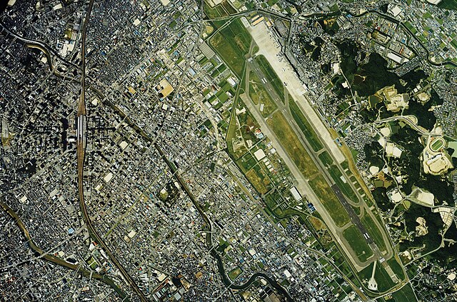
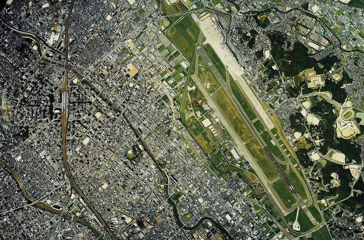
English: Fukuoka Airpot and Hakata Station areas Aerial photograph
日本語: 福岡空港と博多駅周辺の空中写真。Cku-87-1_c9bの12,13,14,15、cku-87-1_c10の18,19,20,21、合計8枚を合成作成。 |
| Date | |
| Source | 国土情報ウェブマッピングシステム |
| Author | 国土交通省 |
Licensing edit

|
The copyright holder of this file, the Ministry of Land, Infrastructure, Transport and Tourism of Japan, allows anyone to use it for any purpose, provided that the copyright holder is properly attributed. Redistribution, derivative work, commercial use, and all other use is permitted. |
Attribution:
Copyright © National Land Image Information (Color Aerial Photographs), Ministry of Land, Infrastructure, Transport and Tourism
|
 |
This image is copyrighted by the Ministry of Land, Infrastructure, Transport and Tourism of Japan. For terms of use, see the stipulation to use of National Land Information (in Japanese) and message from MLIT (in Japanese and English). When you display this image on an article, include the following phrase in the description: "Made based on National Land Image Information (Color Aerial Photographs), Ministry of Land, Infrastructure, Transport and Tourism".
|
File history
Click on a date/time to view the file as it appeared at that time.
| Date/Time | Thumbnail | Dimensions | User | Comment | |
|---|---|---|---|---|---|
| current | 04:08, 15 August 2013 | | 7,336 × 4,844 (36.58 MB) | さかおり (talk | contribs) | {{Information |Description ={{en|1=Fukuoka Airpot and Hakata Station areas Aerial photograph}} {{ja|1=福岡空港と博多駅周辺の空中写真。Cku-87-1_c9bの12,13,14,15、cku-87-1_c10の18,19,20,21、合計8枚を合成作成。}} |Source ... |
You cannot overwrite this file.
File usage on Commons
The following 2 pages use this file:
File usage on other wikis
The following other wikis use this file:
- Usage on ja.wikipedia.org
- Usage on zh.wikipedia.org