File:Futaba district, Fukushima Prefecture.svg

Size of this PNG preview of this SVG file: 632 × 512 pixels. Other resolutions: 296 × 240 pixels | 593 × 480 pixels | 948 × 768 pixels | 1,264 × 1,024 pixels | 2,528 × 2,048 pixels.
Original file (SVG file, nominally 632 × 512 pixels, file size: 34 KB)
Captions
Captions
Add a one-line explanation of what this file represents
Summary edit
| Description |
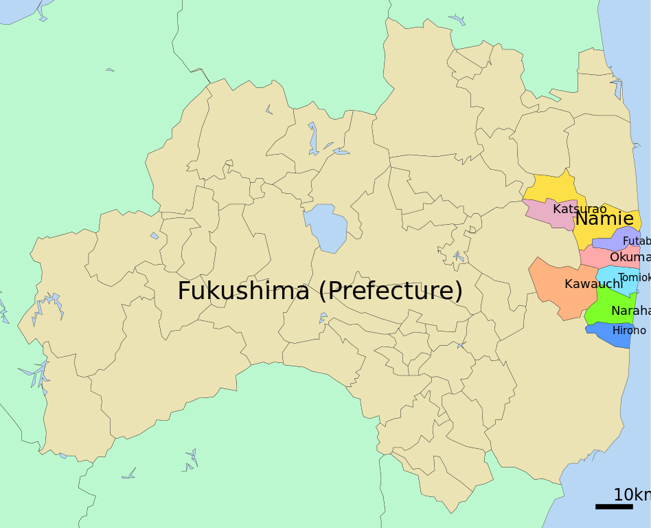
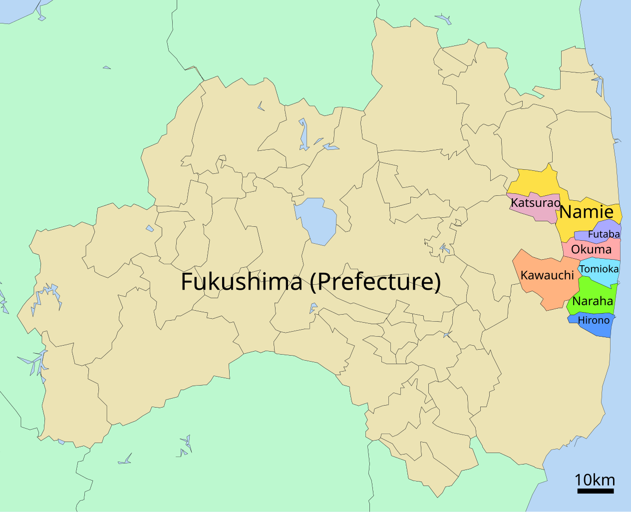
Français : Carte schématique des 8 municipalités du district de Futaba, dans la préfecture de Fukushima (Japon), où est située la Centrale Nucléaire de Fukushima-Daiichi English: Sketch map for the 8 municipalities of the Futaba District, in the Fukushima Prefecture (Japan), where the Fukushima Daiichi NPP is located |
| Date | |
| Source | derivative work: original source is File:Iitate_in_Fukushima_Prefecture_Ja.svg by User:Lincun |
| Author | ConradMayhew |
Licensing edit
I, the copyright holder of this work, hereby publish it under the following license:
This file is licensed under the Creative Commons Attribution-Share Alike 3.0 Unported license.
- You are free:
- to share – to copy, distribute and transmit the work
- to remix – to adapt the work
- Under the following conditions:
- attribution – You must give appropriate credit, provide a link to the license, and indicate if changes were made. You may do so in any reasonable manner, but not in any way that suggests the licensor endorses you or your use.
- share alike – If you remix, transform, or build upon the material, you must distribute your contributions under the same or compatible license as the original.
File history
Click on a date/time to view the file as it appeared at that time.
| Date/Time | Thumbnail | Dimensions | User | Comment | |
|---|---|---|---|---|---|
| current | 14:21, 29 December 2011 | | 632 × 512 (34 KB) | ConradMayhew (talk | contribs) |
You cannot overwrite this file.
File usage on Commons
There are no pages that use this file.
File usage on other wikis
The following other wikis use this file:
- Usage on fr.wikipedia.org
- Usage on uk.wikipedia.org
- Usage on www.wikidata.org