File:GENERAL VIEW OF THE DAME AT THE HEADWATER OF THE POWER CANAL, LOOKING SOUTHEAST - Columbia Canal and Power Plant, Waterfront of Broad River, Columbia, Richland County, SC HAER SC,40-COLUM,18-65.tif
Size of this JPG preview of this TIF file: 746 × 599 pixels. Other resolutions: 299 × 240 pixels | 598 × 480 pixels | 956 × 768 pixels | 1,275 × 1,024 pixels | 2,549 × 2,048 pixels | 4,982 × 4,003 pixels.
Original file (4,982 × 4,003 pixels, file size: 19.02 MB, MIME type: image/tiff)
Captions
Captions
Add a one-line explanation of what this file represents
Summary edit
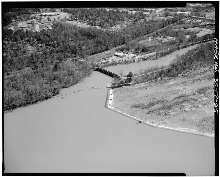
| GENERAL VIEW OF THE DAME AT THE HEADWATER OF THE POWER CANAL, LOOKING SOUTHEAST - Columbia Canal and Power Plant, Waterfront of Broad River, Columbia, Richland County, SC
( |
||||||||||||||||||||||||||
|---|---|---|---|---|---|---|---|---|---|---|---|---|---|---|---|---|---|---|---|---|---|---|---|---|---|---|
| Photographer |
|
|||||||||||||||||||||||||
| Title |
GENERAL VIEW OF THE DAME AT THE HEADWATER OF THE POWER CANAL, LOOKING SOUTHEAST - Columbia Canal and Power Plant, Waterfront of Broad River, Columbia, Richland County, SC |
|||||||||||||||||||||||||
| Description |
Columbia Water Power Company; South Carolina Electric and Gas Company; Southern Railway; Cary, Brian, transmitter |
|||||||||||||||||||||||||
| Depicted place | South Carolina; Richland County; Columbia | |||||||||||||||||||||||||
| Date | 1986 | |||||||||||||||||||||||||
| Dimensions | 4 x 5 in. | |||||||||||||||||||||||||
| Current location |
Library of Congress Prints and Photographs Division Washington, D.C. 20540 USA http://hdl.loc.gov/loc.pnp/pp.print |
|||||||||||||||||||||||||
| Accession number |
HAER SC,40-COLUM,18-65 |
|||||||||||||||||||||||||
| Credit line |
|
|||||||||||||||||||||||||
| Notes |
|
|||||||||||||||||||||||||
| References |
|
|||||||||||||||||||||||||
| Source | https://www.loc.gov/pictures/item/sc0759.photos.150683p | |||||||||||||||||||||||||
| Permission (Reusing this file) |
|
|||||||||||||||||||||||||

File history
Click on a date/time to view the file as it appeared at that time.
| Date/Time | Thumbnail | Dimensions | User | Comment | |
|---|---|---|---|---|---|
| current | 18:05, 1 August 2014 |  | 4,982 × 4,003 (19.02 MB) | Fæ (talk | contribs) | GWToolset: Creating mediafile for Fæ. HABS 2014-08-01 (3201:3400) |
You cannot overwrite this file.
File usage on Commons
The following page uses this file: