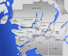
File:GVA-map.png

Size of this preview: 724 × 600 pixels. Other resolutions: 290 × 240 pixels | 579 × 480 pixels | 846 × 701 pixels.
Original file (846 × 701 pixels, file size: 223 KB, MIME type: image/png)
File information
Structured data
Captions
Captions
Add a one-line explanation of what this file represents
Summary edit
| DescriptionGVA-map.png | Blank map of the Greater Vancouver Area, British Columbia, Canada. |
| Date | |
| Source | GIS data |
| Author | Qyd (talk · contribs) |
| Permission (Reusing this file) |
All |
| Other versions |
 |

|
File:GVRD - blank.svg is a vector version of this file. It should be used in place of this PNG file when not inferior.
File:GVA-map.png → File:GVRD - blank.svg
For more information, see Help:SVG.
|
== Where are you going to be in ten years......well if you don't know then you should go to www.wikipedia/work.com to help find where you are going to be in ten years ==
Licensing edit
| Public domainPublic domainfalsefalse |
| I, the copyright holder of this work, release this work into the public domain. This applies worldwide. In some countries this may not be legally possible; if so: I grant anyone the right to use this work for any purpose, without any conditions, unless such conditions are required by law. |
File history
Click on a date/time to view the file as it appeared at that time.
| Date/Time | Thumbnail | Dimensions | User | Comment | |
|---|---|---|---|---|---|
| current | 21:07, 2 January 2007 |  | 846 × 701 (223 KB) | Qyd (talk | contribs) | pale sea |
| 20:25, 2 January 2007 |  | 846 × 701 (231 KB) | Qyd (talk | contribs) | {{Information |Description=Blank map of the Greater Vancouver Area, [[British Columbia, Canada |Source=GIS data |Date=Jan 2007 |Author={{User|Qyd}} |Permission=All |other_versions=Image:Greater Vancouver Area.png (with municipalities names) } |
You cannot overwrite this file.
File usage on Commons
There are no pages that use this file.
File usage on other wikis
The following other wikis use this file:
- Usage on ar.wikipedia.org
- Usage on en.wikipedia.org
- Usage on eo.wikipedia.org
- Usage on fa.wikipedia.org
- الگو:Location map Canada Vancouver
- فرودگاه بینالمللی آبی ونکوور
- الگو:Location map Canada Vancouver/توضیحات
- الگو:Location map Canada Vancouver/doc
- بیمارستان زنان و مرکز سلامت بی.سی.
- موزه مردمشناسی دانشگاه بریتیش کلمبیا
- مترو ونکوور
- انگلیش بی، ونکوور
- پل لاینز گیت
- گستاون
- گالری هنر ونکوور
- متروتاون، برنابی
- رنفرو–کولینگوود
- Usage on fr.wikipedia.org
- Usage on id.wikipedia.org
- Usage on ja.wikipedia.org
- Usage on kn.wikipedia.org
- Usage on pl.wikipedia.org
View more global usage of this file.
