File:Galiuro Wilderness Map.jpg

Size of this preview: 453 × 599 pixels. Other resolutions: 181 × 240 pixels | 550 × 727 pixels.
Original file (550 × 727 pixels, file size: 56 KB, MIME type: image/jpeg)
Captions
Captions
Add a one-line explanation of what this file represents
| Description |
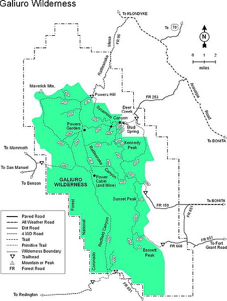
English: Map of Galiuro Wilderness in the Galiuro Mountains — Coronado National Forest of southeastern Arizona. |
|||
| Source | US Forest Service[1] | |||
| Author | USFS, Coronado National Forest. | |||
| Permission (Reusing this file) |
|
File history
Click on a date/time to view the file as it appeared at that time.
| Date/Time | Thumbnail | Dimensions | User | Comment | |
|---|---|---|---|---|---|
| current | 23:53, 29 March 2008 | | 550 × 727 (56 KB) | Axcordion~commonswiki (talk | contribs) | {{Information |Description=Map of Galiuro Wilderness in the Coronado National Forest of southeast Arizona, USA. |Source=US Forest Service[http://www.fs.fed.us/r3/coronado/forest/recreation/wilderness/galiuro.shtml] |Date= |Author=USFS |Permission={{PD-USG |
You cannot overwrite this file.
File usage on Commons
There are no pages that use this file.
File usage on other wikis
The following other wikis use this file:
- Usage on en.wikipedia.org
- Usage on www.wikidata.org