File:Gambia sat.png
No higher resolution available.
Gambia_sat.png (728 × 186 pixels, file size: 155 KB, MIME type: image/png)
Captions
Captions
Add a one-line explanation of what this file represents
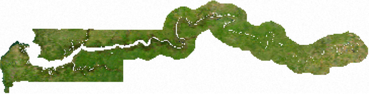
ECW to TIFF to PNG (compression level 9).
| This file is in the public domain, because it was generated by a user, using free sources available at The Map Library.
Note that this does not include the maps in the Global Administrative Areas section of the homepage. |
File history
Click on a date/time to view the file as it appeared at that time.
| Date/Time | Thumbnail | Dimensions | User | Comment | |
|---|---|---|---|---|---|
| current | 01:19, 14 July 2006 | 728 × 186 (155 KB) | Unquietwiki (talk | contribs) | ECW to TIFF to PNG (compression level 9). {{PD-MapLibrary}} |
You cannot overwrite this file.
File usage on Commons
The following page uses this file:
File usage on other wikis
The following other wikis use this file:
- Usage on de.wikipedia.org
- Usage on en.wikipedia.org
- Usage on es.wikipedia.org
- Usage on it.wikipedia.org
- Usage on la.wikipedia.org
- Usage on vec.wikipedia.org
- Usage on vi.wikipedia.org