File:Genève, les rues basses.png

Size of this preview: 800 × 374 pixels. Other resolutions: 320 × 149 pixels | 640 × 299 pixels | 1,024 × 478 pixels | 1,797 × 839 pixels.
Original file (1,797 × 839 pixels, file size: 1.49 MB, MIME type: image/png)
Captions
Captions
Add a one-line explanation of what this file represents
Summary edit
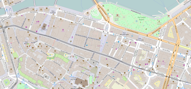
| Description |
English: Map of Geneva downtown, the business area.
Français : Carte du centre ville de Genève : les rues commerçantes (les rues basses). |
| Date | |
| Source | https://www.openstreetmap.org/#map=17/46.20229/6.14907 |
| Author | OpenStreetMap contributors |
| Permission (Reusing this file) |
http://www.openstreetmap.org/copyright |
| Other versions |

Licensing edit
| This work is licensed under the Open Database License (summary). |
This file is licensed under the Creative Commons Attribution-Share Alike 2.0 Generic license.
- You are free:
- to share – to copy, distribute and transmit the work
- to remix – to adapt the work
- Under the following conditions:
- attribution – You must give appropriate credit, provide a link to the license, and indicate if changes were made. You may do so in any reasonable manner, but not in any way that suggests the licensor endorses you or your use.
- share alike – If you remix, transform, or build upon the material, you must distribute your contributions under the same or compatible license as the original.
This file, which was originally posted to
https://www.openstreetmap.org/#map=17/46.20229/6.14907, was reviewed on 5 December 2016 by reviewer INeverCry, who confirmed that it was available there under the stated license on that date.
|
File history
Click on a date/time to view the file as it appeared at that time.
| Date/Time | Thumbnail | Dimensions | User | Comment | |
|---|---|---|---|---|---|
| current | 11:27, 5 December 2016 | | 1,797 × 839 (1.49 MB) | Yann (talk | contribs) | {{Information |Description={{en|Map of Geneva downtown, the business area.}} {{fr|Carte du centre ville de Genève : les rues commerçantes (''les rues basses'').}} |Source=https://www.openstreetmap.org/#map=17/46.20229/6.14907 |Date=2016-12-05 |Author... |
You cannot overwrite this file.
File usage on Commons
The following 15 pages use this file:
- User:Chumwa/OgreBot/Potential transport maps/2016 December 1-10
- User:Chumwa/OgreBot/Transport Maps/2016 December 1-10
- User:Chumwa/OgreBot/Travel and communication maps/2016 December 1-10
- File:2016-OpenStreetMap-Molard.png
- Category:Place de la Fusterie (Geneva)
- Category:Quai du Général-Guisan (Geneva)
- Category:Rue Ardutius-de-Faucigny (Geneva)
- Category:Rue d'Aoste (Geneva)
- Category:Rue de Rive (Geneva)
- Category:Rue de la Confédération (Geneva)
- Category:Rue de la Corraterie (Geneva)
- Category:Rue de la Croix-d'or (Geneva)
- Category:Rue de la Madeleine (Geneva)
- Category:Rue du Marché (Geneva)
- Category:Rue du Rhône (Geneva)
File usage on other wikis
The following other wikis use this file: