File:Genehegyi kilátás.jpg

Size of this preview: 800 × 570 pixels. Other resolutions: 320 × 228 pixels | 640 × 456 pixels | 1,024 × 730 pixels | 1,280 × 912 pixels | 2,560 × 1,824 pixels.
Original file (2,560 × 1,824 pixels, file size: 1.02 MB, MIME type: image/jpeg)
Captions
Captions
Add a one-line explanation of what this file represents
Summary edit
| Description |
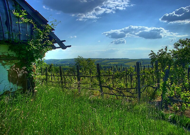
English: Wiev from Genehegy, Söjtör, Hungary.
Magyar: Kilátás Genehegyről. |
| Date | |
| Source | Karakai András |
| Author | Karakai András |
| Camera location | | View this and other nearby images on: OpenStreetMap |
|---|
Licensing edit
I, the copyright holder of this work, hereby publish it under the following licenses:

|
Permission is granted to copy, distribute and/or modify this document under the terms of the GNU Free Documentation License, Version 1.2 or any later version published by the Free Software Foundation; with no Invariant Sections, no Front-Cover Texts, and no Back-Cover Texts. A copy of the license is included in the section entitled GNU Free Documentation License. |
This file is licensed under the Creative Commons Attribution-Share Alike Attribution-Share Alike 4.0 International, 3.0 Unported, 2.5 Generic, 2.0 Generic and 1.0 Generic license.
- You are free:
- to share – to copy, distribute and transmit the work
- to remix – to adapt the work
- Under the following conditions:
- attribution – You must give appropriate credit, provide a link to the license, and indicate if changes were made. You may do so in any reasonable manner, but not in any way that suggests the licensor endorses you or your use.
- share alike – If you remix, transform, or build upon the material, you must distribute your contributions under the same or compatible license as the original.
You may select the license of your choice.
File history
Click on a date/time to view the file as it appeared at that time.
| Date/Time | Thumbnail | Dimensions | User | Comment | |
|---|---|---|---|---|---|
| current | 17:04, 6 August 2010 | | 2,560 × 1,824 (1.02 MB) | Ras67 (talk | contribs) | losslessly cropped with Jpegcrop |
| 21:00, 14 June 2009 |  | 2,722 × 1,990 (1.07 MB) | Karakai.andras (talk | contribs) | {{Information |Description={{en|1=Wiev from Genehegy, Söjtör, Hungary.}} {{hu|1=Kilátás Genehegyről.}} |Source=Karakai András |Author=Karakai András |Date=2008.05.12. |Permission= |other_versions= }} <!--{{ImageUpload|full}}--> [[Category:söjtör |
You cannot overwrite this file.
File usage on Commons
The following 9 pages use this file:
- Commons:A Wikimédia Magyarország képversenye/Eredmény/2. kategória
- Commons:A Wikimédia Magyarország képversenye/Pályázatok
- Commons:A Wikimédia Magyarország képversenye/Értékelés/2. kategória
- Commons:Wikimedia Hungary picture competition/Results/Category 2
- Commons:Wikimedia Hungary picture competition/Submissions
- Category:Maps of Zala County
- Category:Transport in Zala County
- Category:Views of Zala County
- Category:Zala County
File usage on other wikis
The following other wikis use this file:
- Usage on ar.wikipedia.org
- Usage on az.wikipedia.org
- Usage on ca.wikipedia.org
- Usage on ceb.wikipedia.org
- Usage on cs.wikipedia.org
- Usage on en.wikipedia.org
- Usage on eo.wikipedia.org
- Usage on es.wikipedia.org
- Usage on eu.wikipedia.org
- Usage on fa.wikipedia.org
- Usage on fi.wikipedia.org
- Usage on fr.wikipedia.org
- Usage on gl.wikipedia.org
- Usage on hu.wikipedia.org
- Usage on ka.wikipedia.org
- Usage on lmo.wikipedia.org
- Usage on myv.wikipedia.org
- Usage on no.wikipedia.org
- Usage on os.wikipedia.org
- Usage on pl.wikipedia.org
- Usage on pl.wikivoyage.org
- Usage on pt.wikipedia.org
- Usage on ro.wikipedia.org
- Usage on ru.wikipedia.org
- Usage on sr.wikipedia.org
- Usage on sv.wikipedia.org
- Usage on sw.wikipedia.org
- Usage on tr.wikipedia.org
- Usage on uk.wikipedia.org
- Usage on ur.wikipedia.org
- Usage on www.wikidata.org
- Usage on zh.wikipedia.org