File:General official atlas of Wayne County, Michigan - containing general maps of Wayne County and city of Detroit, general township maps ... LOC map50000701-19.jpg

Size of this preview: 470 × 599 pixels. Other resolutions: 188 × 240 pixels | 377 × 480 pixels | 603 × 768 pixels | 804 × 1,024 pixels | 1,607 × 2,048 pixels | 6,750 × 8,600 pixels.
Original file (6,750 × 8,600 pixels, file size: 7.21 MB, MIME type: image/jpeg)
Captions
Captions
Add a one-line explanation of what this file represents
Summary
edit| Description |
English: LeGear. Atlases of the United States, 5030 Includes indexes. Available also through the Library of Congress Web site as a raster image. |
||
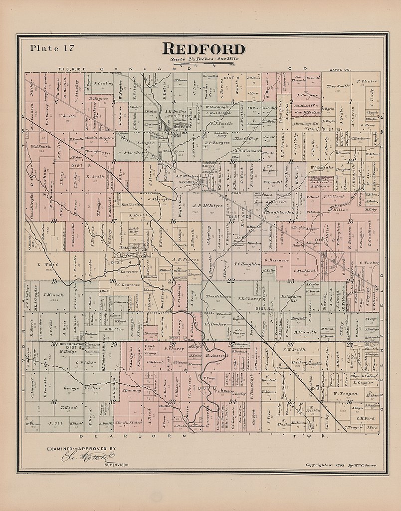
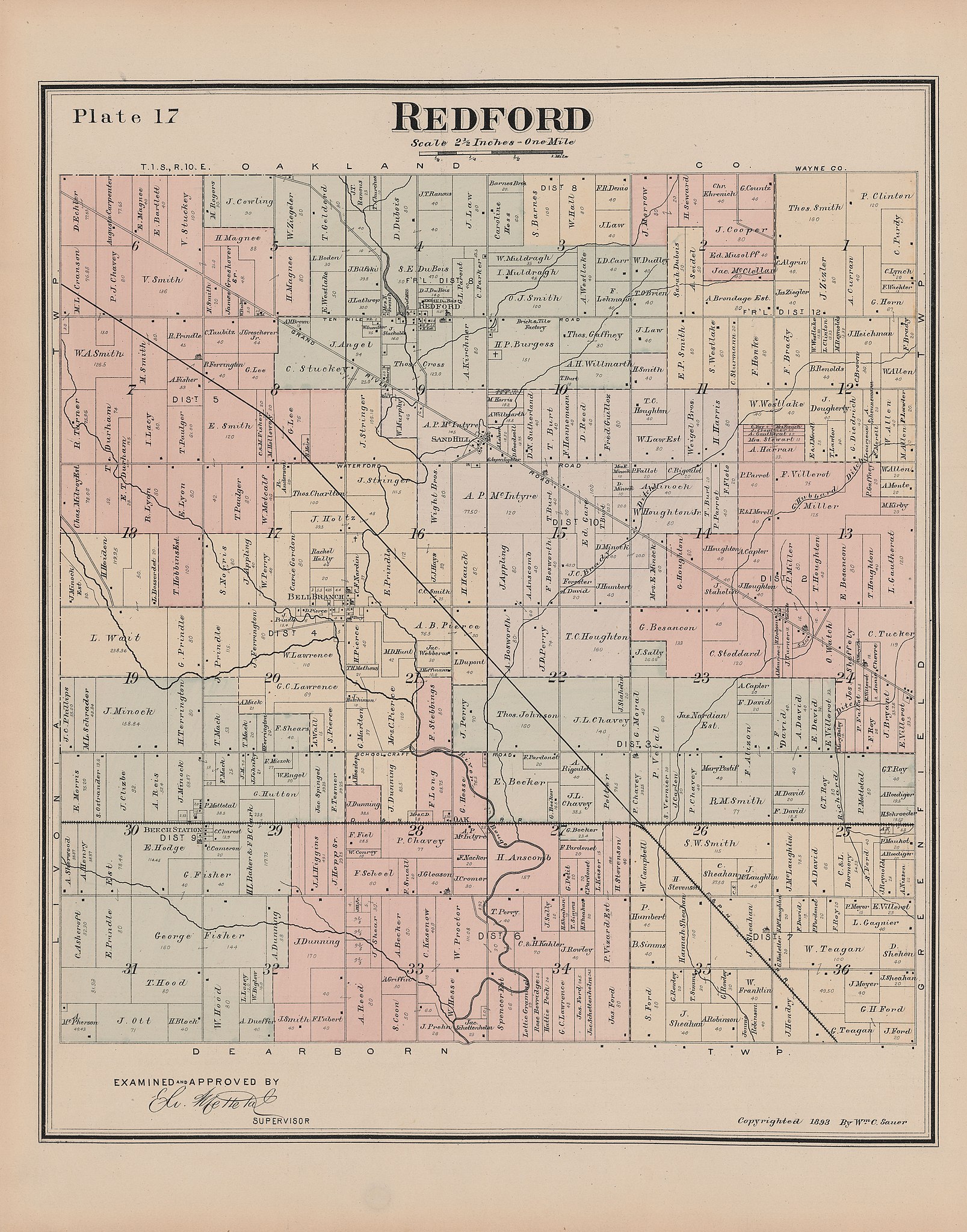
| Title | General official atlas of Wayne County, Michigan : containing general maps of Wayne County and city of Detroit, general township maps ... | ||
| Shelf ID | G1413.W3 S24 1893 | ||
| Parent | https://www.loc.gov/resource/g4113wm.gla00498/ | ||
| Sheet title | Image 19 of General official atlas of Wayne County, Michigan : containing general maps of Wayne County and city of Detroit, general township maps ... | ||
| Date | |||
| Source | https://www.loc.gov/item/map50000701/ | ||
| Author | Sauer, Wm. C. | ||
| Permission (Reusing this file) |
|
||
| Other versions |
|
||
| Location | Wayne County · United States · Michigan · Wayne County. | ||
| Part of | American Memory · Catalog · County Landownership Maps · Geography And Map Division · Cultural Landscapes | ||
| Subject | Wayne County · Wayne County (Mich.) · Michigan · United States · Maps · Real Property · Landowners |


Licensing
edit
|
This is a faithful photographic reproduction of a two-dimensional, public domain work of art. The work of art itself is in the public domain for the following reason:
The official position taken by the Wikimedia Foundation is that "faithful reproductions of two-dimensional public domain works of art are public domain".
This photographic reproduction is therefore also considered to be in the public domain in the United States. In other jurisdictions, re-use of this content may be restricted; see Reuse of PD-Art photographs for details. | ||||
File history
Click on a date/time to view the file as it appeared at that time.
| Date/Time | Thumbnail | Dimensions | User | Comment | |
|---|---|---|---|---|---|
| current | 10:45, 9 July 2019 | | 6,750 × 8,600 (7.21 MB) | Fæ (talk | contribs) | LOC Maps multisheet https://www.loc.gov/item/map50000701/ sheet 19 of 41 #18968 |
You cannot overwrite this file.
File usage on Commons
The following page uses this file: