File:General soil map, Sabine and San Augustine counties, Texas LOC 92682922.tif

Size of this JPG preview of this TIF file: 379 × 599 pixels. Other resolutions: 152 × 240 pixels | 303 × 480 pixels | 485 × 768 pixels | 647 × 1,024 pixels | 1,295 × 2,048 pixels | 7,311 × 11,563 pixels.
Original file (7,311 × 11,563 pixels, file size: 241.86 MB, MIME type: image/tiff)
Captions
Captions
Add a one-line explanation of what this file represents
Summary edit
| Warning | The original file is very high-resolution. It might not load properly or could cause your browser to freeze when opened at full size. |
|---|
| Description |
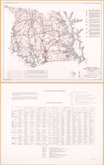
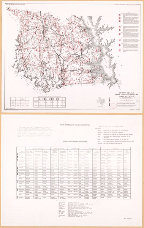
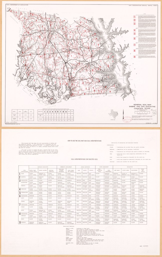
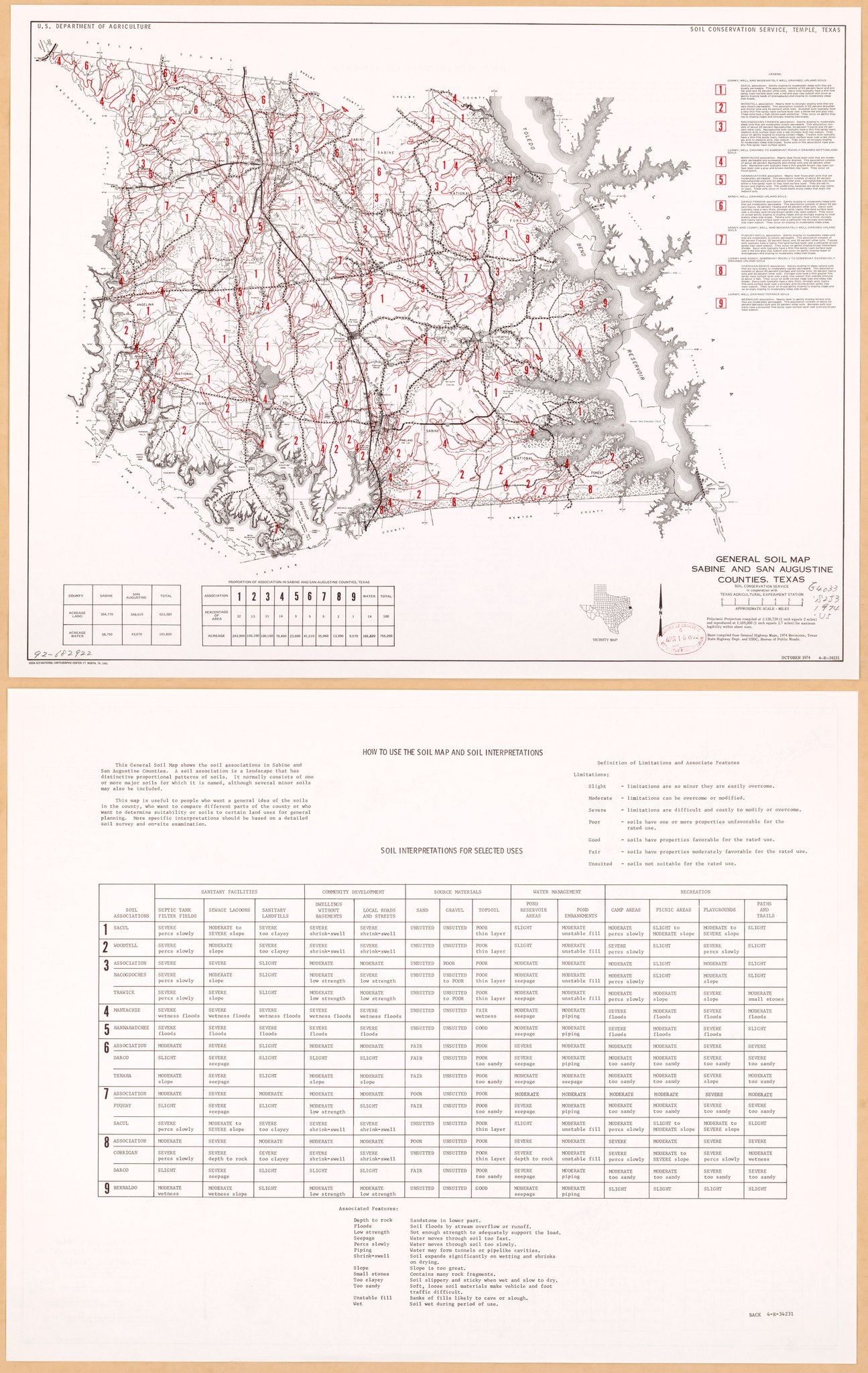
English: "October 1974 4-R-34231." Depths shown by form lines. "This general soil map is suitable for broad planning purposes only." In upper margin: U.S. Department of Agriculture, Soil Conservation Service. "Base compiled from Texas general highway maps." Includes location map, table of Proportion of association in Sabine and San Augustine ounties, and descriptive legend. Text and table "Soil interpretations for selected uses" on verso. Available also through the Library of Congress Web site as a raster image. |
||
| Title | General soil map, Sabine and San Augustine counties, Texas | ||
| Shelf ID | G4033.S2J3 1974 .U5 | ||
| Date | |||
| Source | https://www.loc.gov/item/92682922/ | ||
| Author | National Cartographic Center (U.S.); Texas Agricultural Experiment Station; United States. Soil Conservation Service | ||
| Permission (Reusing this file) |
|
||
| Other versions |
|
||
| Location | San Augustine County · Sabine County. · San Augustine County. · Sabine County · United States · Texas | ||
| Part of | American Memory · Catalog · Geography And Map Division · Additional Conservation And Environment Cartographic Items | ||
| Subject | San Augustine County · Soils · Sabine County · United States · Maps · Texas |

Licensing edit
| This work is from the Library of Congress. According to the library, there are no known copyright restrictions on the use of this work. |  |
File history
Click on a date/time to view the file as it appeared at that time.
| Date/Time | Thumbnail | Dimensions | User | Comment | |
|---|---|---|---|---|---|
| current | 22:08, 19 January 2020 |  | 7,311 × 11,563 (241.86 MB) | Fæ (talk | contribs) | LOC Maps https://www.loc.gov/item/92682922/ #11012 |
You cannot overwrite this file.
File usage on Commons
There are no pages that use this file.