File:Generalized geologic map of yosemite national park and vicinity.jpg

Size of this preview: 471 × 599 pixels. Other resolutions: 188 × 240 pixels | 377 × 480 pixels | 603 × 768 pixels | 805 × 1,024 pixels | 1,409 × 1,793 pixels.
Original file (1,409 × 1,793 pixels, file size: 1.15 MB, MIME type: image/jpeg)
Captions
Captions
Add a one-line explanation of what this file represents
Summary edit
| Description |
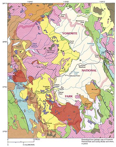
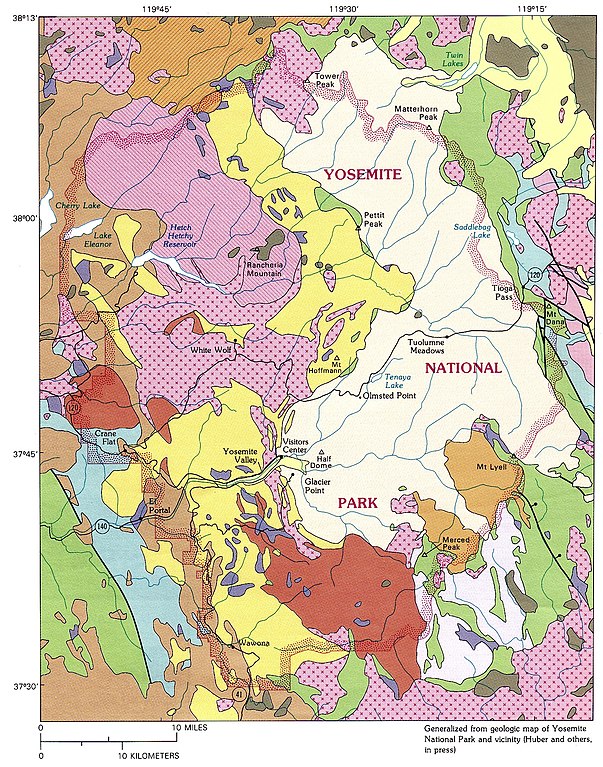
English: A generalized geologic map of Yosemite National Park and nearby areas. For a key, see File:General geologic map of Yosemite area.png. |
| Date | |
| Source | Image: [1]. Linked from [2], part of [3], a digitized version of: Norman King Huber (1926 - 2007), The Geologic Story of Yosemite National Park (Washington: Government Printing Office, 1987). USGS Bulletin 1595. |
| Author | N. King Huber, USGS. |
| Other versions |
|

![[1]](http://www.yosemite.ca.us/library/geologic_story_of_yosemite/images/geologic_map_of_yosemite_national_park_and_vicinity.jpg)
Licensing edit
This image is in the public domain in the United States because it only contains materials that originally came from the United States Geological Survey, an agency of the United States Department of the Interior. For more information, see the official USGS copyright policy.
|
File history
Click on a date/time to view the file as it appeared at that time.
| Date/Time | Thumbnail | Dimensions | User | Comment | |
|---|---|---|---|---|---|
| current | 15:30, 26 May 2012 | | 1,409 × 1,793 (1.15 MB) | Avenue (talk | contribs) | {{Information |Description ={{en|1=A generalized geologic map of Yosemite National Park and nearby areas. For a key, see File:General geologic map of Yosemite area.png.}} |Source =[http://www.yosemite.ca.us/library/geologic_story_of_yos... |
You cannot overwrite this file.
File usage on Commons
The following 2 pages use this file: