File:Geographisches Kriegs-Theatrum der Kaÿserlichen und Reichs- wie auch Frantzösischen Armee am Rhein-Strom , samt dem Mose - urn-nbn-de-0128-1-8991.jpg

Size of this preview: 774 × 600 pixels. Other resolutions: 310 × 240 pixels | 620 × 480 pixels | 991 × 768 pixels | 1,280 × 992 pixels | 2,560 × 1,983 pixels | 14,642 × 11,344 pixels.
Original file (14,642 × 11,344 pixels, file size: 29.53 MB, MIME type: image/jpeg)
Captions
Captions
Add a one-line explanation of what this file represents
| Warning | The original file is very high-resolution. It might not load properly or could cause your browser to freeze when opened at full size. |
|---|
Summary edit
| Title |
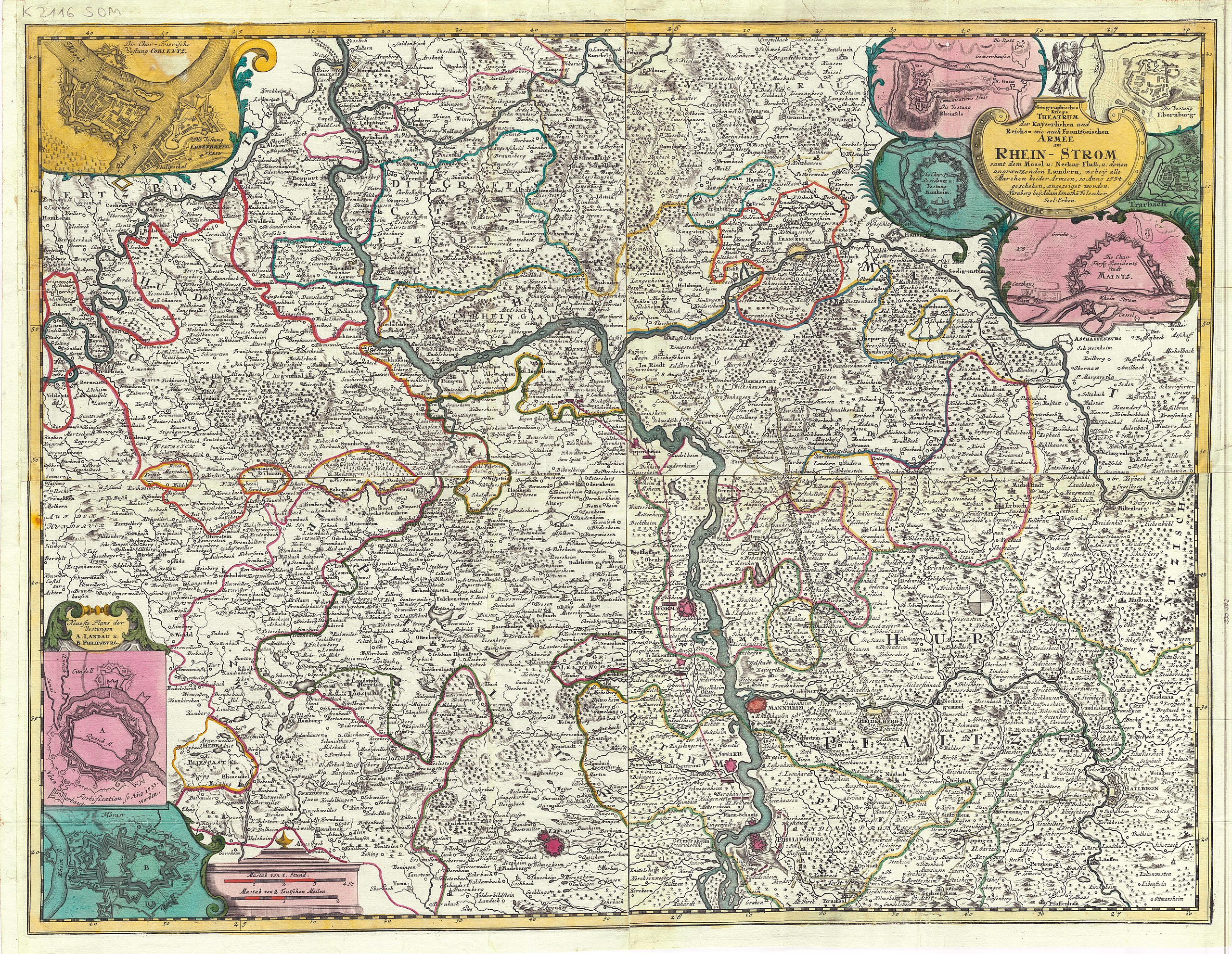
Geographisches Kriegs-Theatrum der Kaÿserlichen und Reichs- wie auch Frantzösischen Armee am Rhein-Strom : samt dem Mosel- u. Neckar-Fluß, u. denen angraentzenden Laendern, wobeÿ alle Marchen beider Armeen, so Anno 1734 geschehen, angezeiget worden |
|||||||||||||
| Description |
Nürnberg : 1734 [nach 1734]; [Electronic ed.] Koblenz : Landesbibliothekszentrum Rheinland-Pfalz, 2010. |
|||||||||||||
| Date | 1734 | |||||||||||||
| Dimensions | 1 Kt. auf 4 Bl. : Kupferstich. ; Gesamtgr. 73 x 56 cm [ca. 1:220.000] | |||||||||||||
| Collection |
|
|||||||||||||
| Accession number | ||||||||||||||
| Credit line | dilibri Rheinland-Pfalz / Europeana | |||||||||||||
| Source/Photographer |
dilibri Rheinland-Pfalz / Europeana
|
|||||||||||||
| Permission (Reusing this file) |
This file is licensed under the Creative Commons Attribution-Share Alike 2.0 Germany license. Attribution: dilibri Rheinland-Pfalz
 |
|||||||||||||
File history
Click on a date/time to view the file as it appeared at that time.
| Date/Time | Thumbnail | Dimensions | User | Comment | |
|---|---|---|---|---|---|
| current | 12:13, 24 September 2012 | | 14,642 × 11,344 (29.53 MB) | Denniss (talk | contribs) | -progressive |
| 10:01, 7 June 2011 |  | 14,642 × 11,344 (28.24 MB) | BotMultichill (talk | contribs) | {{User:Multichill/Europeana |europeana:uri=http://www.europeana.eu/resolve/record/09428/CDD00D311234F78A602B7057020826F849A39898 |dc:language=de |enrichment:period_begin=Fri Jan 01 01:00:00 CET 1734 |europeana:hasObject=false |dc:title=Geographisches Krie |
You cannot overwrite this file.
File usage on Commons
The following page uses this file: