File:German defence works at Lille in November 1915.jpg

Size of this preview: 800 × 561 pixels. Other resolutions: 320 × 225 pixels | 640 × 449 pixels | 1,024 × 719 pixels | 1,280 × 898 pixels | 2,560 × 1,797 pixels | 3,001 × 2,106 pixels.
Original file (3,001 × 2,106 pixels, file size: 1.04 MB, MIME type: image/jpeg)
Captions
Captions
Add a one-line explanation of what this file represents
| Title |
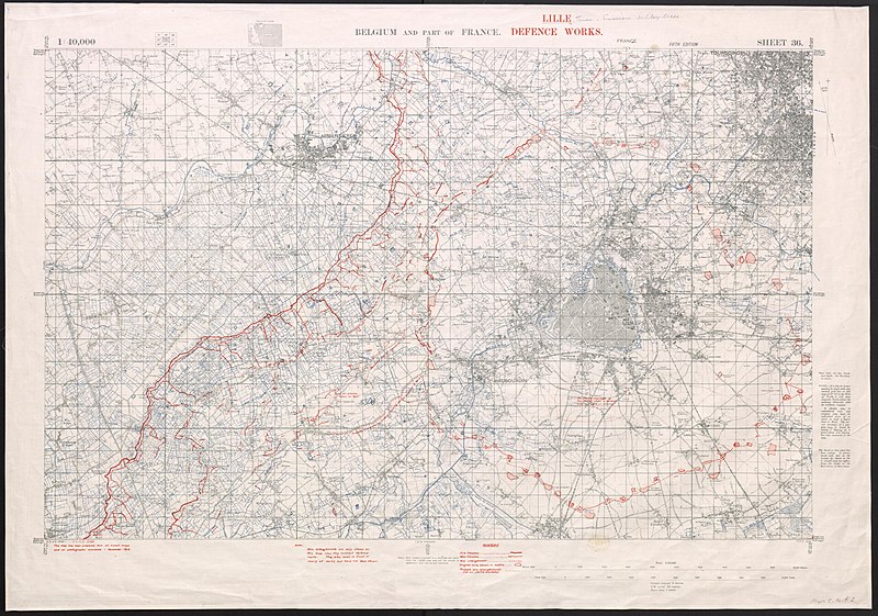
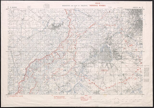
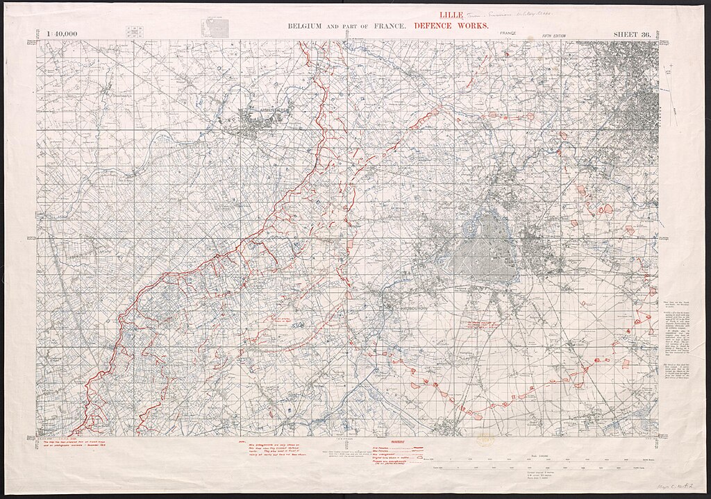
English: Lille defence works |
|||||||||
| Description |
English: Lille defence works. Scale, 1 : 40,000. Fifth edition. Based on maps and maps avail in November 1914 . |
|||||||||
| Date | ||||||||||
| Source |
|
|||||||||
| Creator |
War Office. General Staff. Geographical Section, Field Service Battalion, Royal Engineers |
|||||||||
| Permission (Reusing this file) |
|
|||||||||
| Geotemporal data | ||||||||||
| Map location | Lille | |||||||||
| Map type | trench map | |||||||||
| Scale | 1:40,000 | |||||||||
| Heading |
 |
|||||||||
| Bounding box |
|
|||||||||
| Georeferencing | ||||||||||
| Bibliographic data | ||||||||||
| Map sheet | 36 | |||||||||
| Language | English | |||||||||
| Publisher |
Royal Engineers |
|||||||||
| Archival data | ||||||||||
| Collection | ||||||||||
| Accession number |
016553247 |
|||||||||
| Dimensions | height: 910 mm (35.82 in); width: 360 mm (14.17 in) | |||||||||


File history
Click on a date/time to view the file as it appeared at that time.
| Date/Time | Thumbnail | Dimensions | User | Comment | |
|---|---|---|---|---|---|
| current | 18:38, 2 November 2014 | | 3,001 × 2,106 (1.04 MB) | Labattblueboy (talk | contribs) | {{Information |Description=Lille defence works. Scale, 1 : 40,000. Fifth edition. Based on maps and maps avail in November 1914 |Source={{British Library image |url=http://access.bl.uk/item/viewer/ark:/81055/vdc_100022522694.0x000002#ark:/81055/vdc_100... |
You cannot overwrite this file.
File usage on Commons
The following 2 pages use this file: