File:Gettysburg Day2 Culp's Hill Evening.png
Size of this preview: 500 × 600 pixels. Other resolutions: 200 × 240 pixels | 400 × 480 pixels | 640 × 768 pixels | 853 × 1,024 pixels | 1,707 × 2,048 pixels | 4,501 × 5,401 pixels.
Original file (4,501 × 5,401 pixels, file size: 8.61 MB, MIME type: image/png)
Captions
Captions
Add a one-line explanation of what this file represents
Summary edit
| Description |
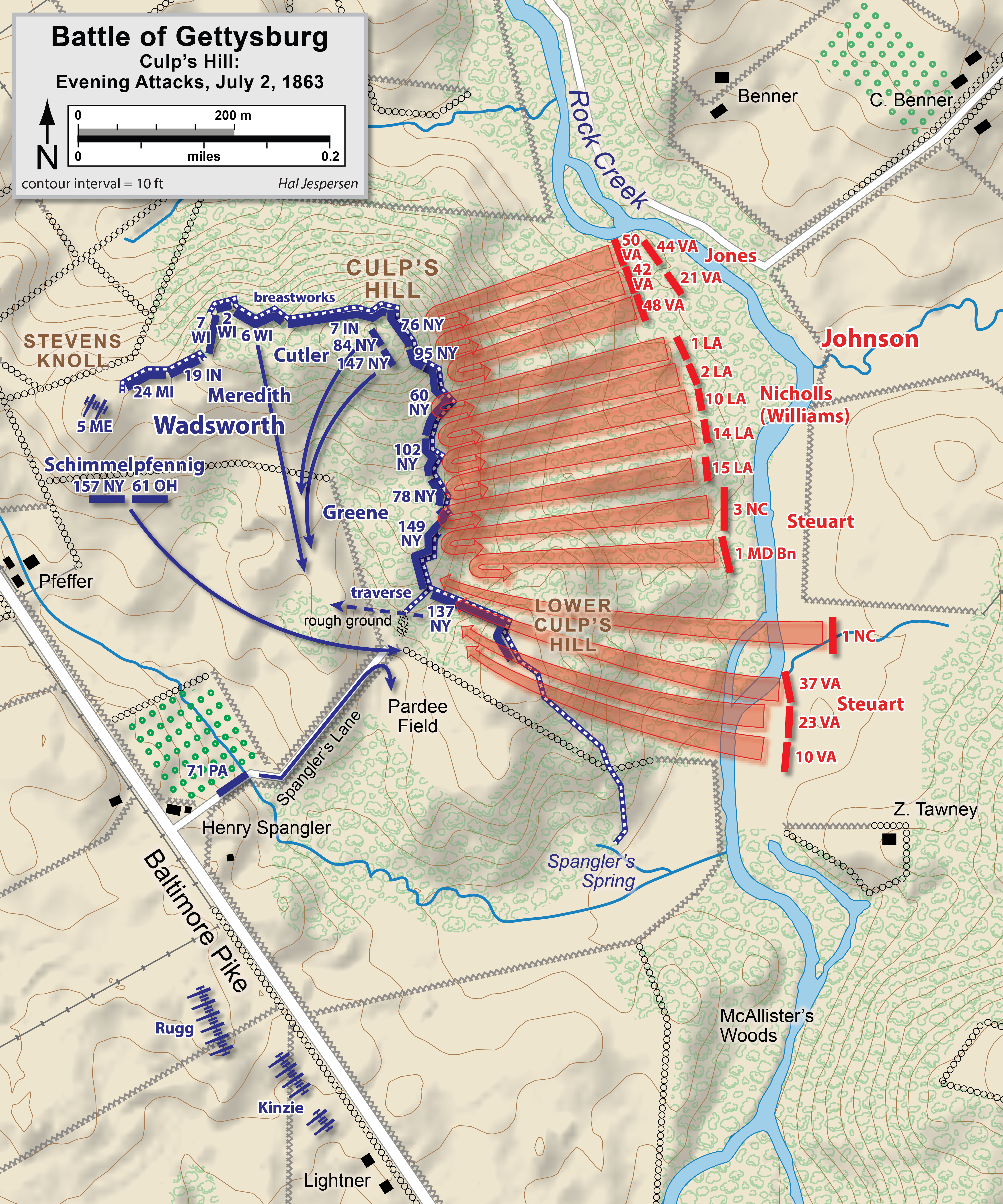
English: (Map of actions in the Battle of Gettysburg, second day, Culp's Hill, evening battle. Drawn by Hal Jespersen in Macromedia Freehand. Graphic source file is available at http://www.posix.com/CWmaps/ New version improves accuracy of unit positions and graphic style that matches others in the Gettysburg series. Drawn by Hal Jespersen in Adobe Illustrator CS5. )
Dansk: Kort over kampene i slaget ved Gettysbirg, anden dag, Culp's Hill, om aftenen. Tegnet af Hal Jespersen |
| Date | |
| Source | Engelsk Wikipedia |
| Author | Hal Jespersen |
Licensing edit
This file is licensed under the Creative Commons Attribution 3.0 Unported license.
Attribution: Map by Hal Jespersen, www.posix.com/CW
- You are free:
- to share – to copy, distribute and transmit the work
- to remix – to adapt the work
- Under the following conditions:
- attribution – You must give appropriate credit, provide a link to the license, and indicate if changes were made. You may do so in any reasonable manner, but not in any way that suggests the licensor endorses you or your use.
File history
Click on a date/time to view the file as it appeared at that time.
| Date/Time | Thumbnail | Dimensions | User | Comment | |
|---|---|---|---|---|---|
| current | 20:11, 25 February 2023 | | 4,501 × 5,401 (8.61 MB) | Hlj (talk | contribs) | improved graphics |
| 20:11, 2 April 2011 |  | 2,325 × 2,683 (1.84 MB) | Hlj (talk | contribs) | Updated graphical format of rivers and roads. Same license. | |
| 18:27, 30 July 2010 |  | 2,325 × 2,683 (1.72 MB) | Hlj (talk | contribs) | New version improves accuracy of unit positions and graphic style that matches others in the Gettysburg series. Drawn by Hal Jespersen in Adobe Illustrator CS5. Graphic source file is available at http://www.posix.com/CWmaps/ {{cc-by-3.0|Map by Hal Jesper | |
| 19:47, 27 December 2008 |  | 350 × 291 (107 KB) | Nis Hoff (talk | contribs) | {{Information |Description={{en|1=(Map of actions in the Battle of Gettysburg, second day, Culp's Hill, evening battle. Drawn by Hal Jespersen in Macromedia Freehand. Graphic source file is available at http://www.posix.com/CWmaps/ {{PD-release}} )}} {{da |
You cannot overwrite this file.
File usage on Commons
The following page uses this file:
File usage on other wikis
The following other wikis use this file:
- Usage on bg.wikipedia.org
- Usage on cs.wikipedia.org
- Usage on da.wikipedia.org
- Usage on en.wikipedia.org
- Usage on fr.wikipedia.org
- Usage on hu.wikipedia.org
- Usage on it.wikipedia.org
- Usage on ja.wikipedia.org
- Usage on ru.wikipedia.org