File:Giurtelecu Simleului in 1941.jpg

Size of this preview: 800 × 533 pixels. Other resolutions: 320 × 213 pixels | 640 × 426 pixels | 908 × 605 pixels.
Original file (908 × 605 pixels, file size: 211 KB, MIME type: image/jpeg)
Captions
Captions
Add a one-line explanation of what this file represents
Summary edit
| Description |
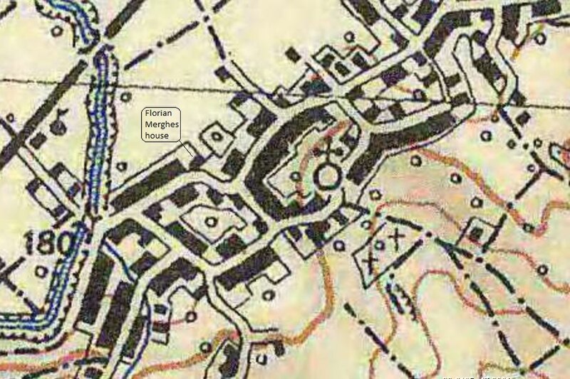
English: A 1941 map of Giurtelecu Şimleului during the Hungarian WWII administration (1940-1944). The map is a part of the 1941 Military Survey of Hungary. The house where the ethnic Romanian Florian Merghes (1905–1945) was living (47.297574, 22.789557) is marked on the map. |
| Date | |
| Source | Military Survey of Hungary (1941) |
| Author | Military Survey of Hungary (1941) |
| Camera location | | View this and other nearby images on: OpenStreetMap |
|---|
Licensing edit
This file is licensed under the Creative Commons Attribution-Share Alike 4.0 International license.
- You are free:
- to share – to copy, distribute and transmit the work
- to remix – to adapt the work
- Under the following conditions:
- attribution – You must give appropriate credit, provide a link to the license, and indicate if changes were made. You may do so in any reasonable manner, but not in any way that suggests the licensor endorses you or your use.
- share alike – If you remix, transform, or build upon the material, you must distribute your contributions under the same or compatible license as the original.
File history
Click on a date/time to view the file as it appeared at that time.
| Date/Time | Thumbnail | Dimensions | User | Comment | |
|---|---|---|---|---|---|
| current | 14:31, 15 January 2018 | | 908 × 605 (211 KB) | Artsaurus (talk | contribs) | User created page with UploadWizard |
You cannot overwrite this file.
File usage on Commons
The following page uses this file: