File:Gloucester and Sharpness Canal Two Mile Bend - geograph.org.uk - 59408.jpg
No higher resolution available.
Gloucester_and_Sharpness_Canal_Two_Mile_Bend_-_geograph.org.uk_-_59408.jpg (640 × 480 pixels, file size: 194 KB, MIME type: image/jpeg)
Captions
Captions
Add a one-line explanation of what this file represents
Summary edit
| Description |
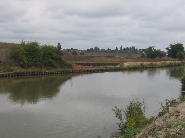
English: Gloucester and Sharpness Canal Two Mile Bend. The canal runs parallel to the Bristol Road out of Gloucester in this square before executing a sharp "S" bend to the left of the photographer. The excavations visible on the other side of the canal are to straighten out this sharp bend, http://www.gloucesterdocks.me.uk/canal/2mcutplans.htm unfortunately not led by the needs of the sea going ships which have used this canal, but instead to gain the necessary clearances to build a new western road bypass for Gloucester! |
| Date | |
| Source | From geograph.org.uk |
| Author | David Stowell |
| Attribution (required by the license) | David Stowell / Gloucester and Sharpness Canal Two Mile Bend / |
| Object location | | View this and other nearby images on: OpenStreetMap |
|---|
_heading:315.00&language=en)
Licensing edit

|
This image was taken from the Geograph project collection. See this photograph's page on the Geograph website for the photographer's contact details. The copyright on this image is owned by David Stowell and is licensed for reuse under the Creative Commons Attribution-ShareAlike 2.0 license.
|
This file is licensed under the Creative Commons Attribution-Share Alike 2.0 Generic license.
Attribution: David Stowell
- You are free:
- to share – to copy, distribute and transmit the work
- to remix – to adapt the work
- Under the following conditions:
- attribution – You must give appropriate credit, provide a link to the license, and indicate if changes were made. You may do so in any reasonable manner, but not in any way that suggests the licensor endorses you or your use.
- share alike – If you remix, transform, or build upon the material, you must distribute your contributions under the same or compatible license as the original.
File history
Click on a date/time to view the file as it appeared at that time.
| Date/Time | Thumbnail | Dimensions | User | Comment | |
|---|---|---|---|---|---|
| current | 15:23, 30 January 2010 | | 640 × 480 (194 KB) | GeographBot (talk | contribs) | == {{int:filedesc}} == {{Information |description={{en|1=Gloucester and Sharpness Canal Two Mile Bend. The canal runs parallel to the Bristol Road out of Gloucester in this square before executing a sharp "S" bend to the left of the photographer. The exc |
You cannot overwrite this file.
File usage on Commons
There are no pages that use this file.