File:Goose Bay Location.png

Size of this preview: 688 × 600 pixels. Other resolutions: 275 × 240 pixels | 551 × 480 pixels | 843 × 735 pixels.
Original file (843 × 735 pixels, file size: 604 KB, MIME type: image/png)
Captions
Captions
Add a one-line explanation of what this file represents
Summary edit
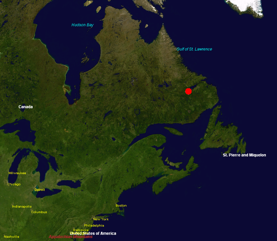
Location of CFB Goose Bay, from NASA World Wind
Licensing edit
| This image is in the public domain because it is a screenshot from NASA’s globe software World Wind using a public domain layer, such as Blue Marble, MODIS, Landsat, SRTM, USGS or GLOBE.
|
 |
File history
Click on a date/time to view the file as it appeared at that time.
| Date/Time | Thumbnail | Dimensions | User | Comment | |
|---|---|---|---|---|---|
| current | 21:09, 20 December 2005 | | 843 × 735 (604 KB) | Schlendrian (talk | contribs) | |
| 20:59, 20 December 2005 |  | 1,280 × 922 (981 KB) | Schlendrian (talk | contribs) | Location of CFB Goose Bay, from NASA World Wind |
You cannot overwrite this file.
File usage on Commons
There are no pages that use this file.
File usage on other wikis
The following other wikis use this file:
- Usage on de.wikipedia.org
- Usage on es.wikipedia.org
- Usage on eu.wikipedia.org
- Usage on pt.wikipedia.org