File:Gorgan Bay, Miankaleh peninsula and Ashuradeh island, LandSat-5 satellite image 01-APR-95.jpg

Size of this preview: 800 × 316 pixels. Other resolutions: 320 × 126 pixels | 640 × 253 pixels | 1,024 × 405 pixels | 2,472 × 977 pixels.
Original file (2,472 × 977 pixels, file size: 542 KB, MIME type: image/jpeg)
Captions
Captions
Add a one-line explanation of what this file represents
Summary edit
| Description |
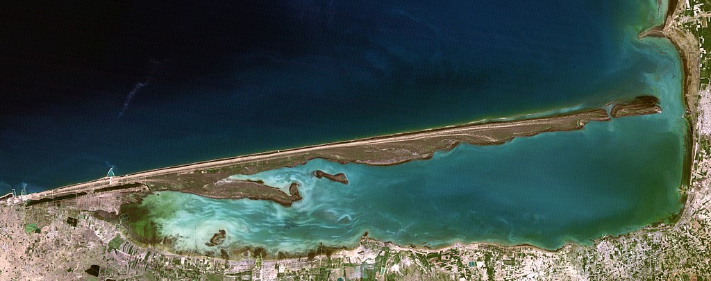
Русский: Горганский залив, отделенный от открытой части Каспийского моря полуостровом Мианкале, у восточной оконечности которого остров Ашур-Ада;
космический снимок LandSat-5 от 1 апреля 1995 года ID:LT05_L1TP_163034_19950401_20170717_01_T1English: Gorgan Bay separated from open waters of the Caspian Sea with the Miankaleh peninsula, it's easternmost tip forms Ashuradeh island;
LandSat-5 satellite image 01-APR-95 ID:LT05_L1TP_163034_19950401_20170717_01_T1 |
| Date | |
| Source | [1] |
| Author | NASA |
Licensing edit
| This file is in the public domain in the United States because it was solely created by NASA. NASA copyright policy states that "NASA material is not protected by copyright unless noted". (See Template:PD-USGov, NASA copyright policy page or JPL Image Use Policy.) | ||
 |
Warnings:
|
File history
Click on a date/time to view the file as it appeared at that time.
| Date/Time | Thumbnail | Dimensions | User | Comment | |
|---|---|---|---|---|---|
| current | 13:33, 14 November 2017 | 2,472 × 977 (542 KB) | Bogomolov.PL (talk | contribs) | better quality version | |
| 21:15, 8 November 2017 | 2,597 × 963 (320 KB) | Bogomolov.PL (talk | contribs) | User created page with UploadWizard |
You cannot overwrite this file.
File usage on Commons
The following 2 pages use this file:
File usage on other wikis
The following other wikis use this file:
- Usage on az.wikipedia.org
- Usage on ceb.wikipedia.org
- Usage on de.wikipedia.org
- Usage on en.wikipedia.org
- Usage on fa.wikipedia.org
- Usage on ml.wikipedia.org
- Usage on mzn.wikipedia.org
- Usage on nl.wikipedia.org
- Usage on pl.wikipedia.org
- Usage on ru.wikipedia.org
- Usage on www.wikidata.org