File:Gottertli.jpg

Size of this preview: 800 × 450 pixels. Other resolutions: 320 × 180 pixels | 640 × 360 pixels | 1,024 × 576 pixels | 1,280 × 720 pixels | 3,072 × 1,728 pixels.
Original file (3,072 × 1,728 pixels, file size: 1.27 MB, MIME type: image/jpeg)
Captions
Captions
Add a one-line explanation of what this file represents
Summary edit
| Description |
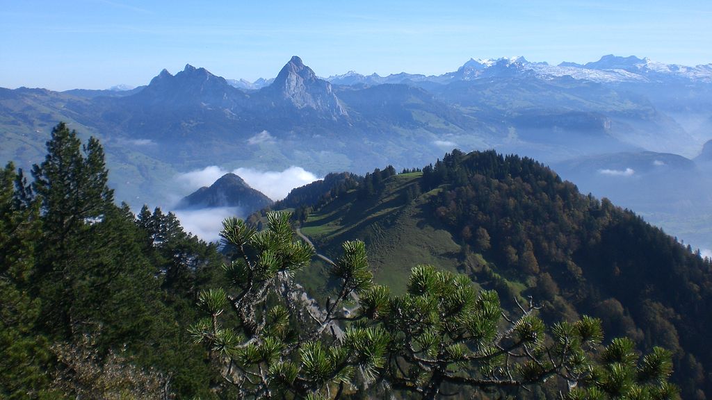
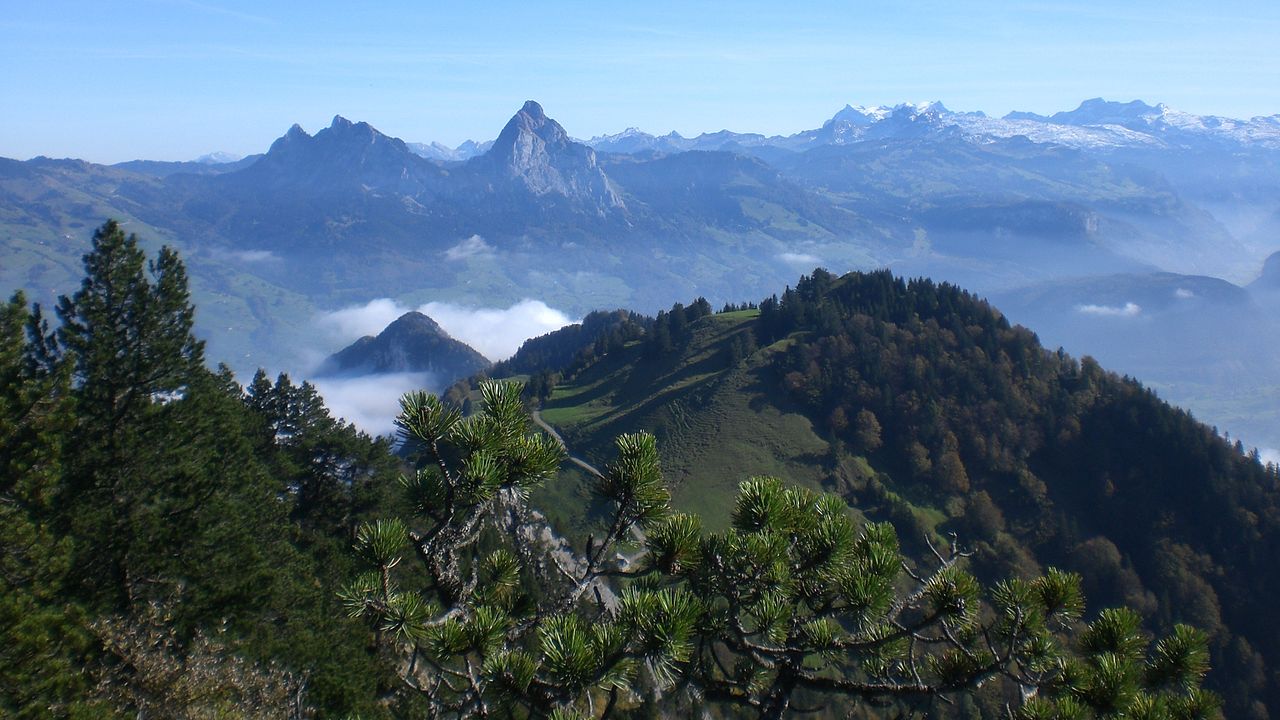
Deutsch: Blick auf Urmiberg & Gottertli (im Mittelgrund die Mythen) vom Anstieg auf Rigi-Hochflue aus ~1.400 m ü. M. |
| Date | Taken on 16 October 2011, 11:58:05 |
| Source | Own work |
| Author | FkMohr, Fotografin Supakon Mohr |
| Camera location | | View this and other nearby images on: OpenStreetMap |
|---|
Licensing edit
Supakon Mohr, the copyright holder of this work, hereby publishes it under the following license:
This file is licensed under the Creative Commons Attribution-Share Alike 3.0 Germany license.
Attribution: Supakon Mohr
- You are free:
- to share – to copy, distribute and transmit the work
- to remix – to adapt the work
- Under the following conditions:
- attribution – You must give appropriate credit, provide a link to the license, and indicate if changes were made. You may do so in any reasonable manner, but not in any way that suggests the licensor endorses you or your use.
- share alike – If you remix, transform, or build upon the material, you must distribute your contributions under the same or compatible license as the original.

Original upload log edit
Transferred from de.wikipedia to Commons by Boteas using CommonsHelper.
The original description page was here. All following user names refer to de.wikipedia.
- 2013-04-10 17:55 FkMohr 3072×1728× (1328065 bytes) {{Information |Beschreibung = Blick auf Urmiberg & Gotterli vom Anstieg auf Rigi-Hochflue aus ~1.400 m ü. M. |Quelle = Eigenes Werk |Urheber = Supakon Mohr |Datum = 16. Oktober 2011 11.58 Uhr |Genehmigung = erte…
| Annotations | This image is annotated: View the annotations at Commons |
File history
Click on a date/time to view the file as it appeared at that time.
| Date/Time | Thumbnail | Dimensions | User | Comment | |
|---|---|---|---|---|---|
| current | 01:39, 15 April 2013 | | 3,072 × 1,728 (1.27 MB) | File Upload Bot (Magnus Manske) (talk | contribs) | Transfered from de.wikipedia by User:Boteas using CommonsHelper |
You cannot overwrite this file.
File usage on Commons
The following 2 pages use this file:
File usage on other wikis
The following other wikis use this file:
- Usage on als.wikipedia.org
- Usage on bg.wikipedia.org
- Usage on de.wikipedia.org
- Usage on en.wikipedia.org
- Usage on es.wikipedia.org
- Usage on ja.wikipedia.org
- Usage on ko.wikipedia.org
- Usage on www.wikidata.org
- Usage on zh.wikipedia.org