File:Grafenstein Schloss 17112006 01a.jpg

Size of this preview: 800 × 392 pixels. Other resolutions: 320 × 157 pixels | 640 × 314 pixels | 1,024 × 502 pixels | 1,280 × 628 pixels | 3,736 × 1,832 pixels.
Original file (3,736 × 1,832 pixels, file size: 1.31 MB, MIME type: image/jpeg)
Captions
Captions
Add a one-line explanation of what this file represents
Summary edit
| Description |
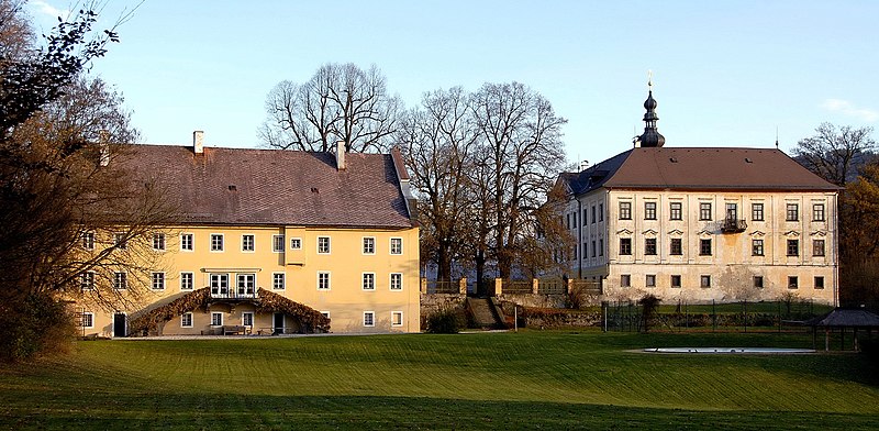
English: Castle Grafenstein of the noble family Orsini-Rosenberg in Grafenstein, municipality Grafenstein, district Klagenfurt-Land, Carinthia, Austria
Deutsch: Schloss Grafenstein (im Bestiz der Adelsfamilie Orsini-Rosenberg) in Grafenstein, Marktgemeinde Grafenstein, Bezirk Klagenfurt-Land, Kärnten, Österreich
|
||
| Date | |||
| Source | Own work | ||
| Author | Johann Jaritz | ||
| Permission (Reusing this file) |
I, the copyright holder of this work, hereby publish it under the following licenses:
This file is licensed under the Creative Commons Attribution-Share Alike 3.0 Austria license.
 You may select the license of your choice. |

| Object location | | View this and other nearby images on: OpenStreetMap |
|---|
| Camera location | | View this and other nearby images on: OpenStreetMap |
|---|
File history
Click on a date/time to view the file as it appeared at that time.
| Date/Time | Thumbnail | Dimensions | User | Comment | |
|---|---|---|---|---|---|
| current | 10:15, 3 October 2007 | | 3,736 × 1,832 (1.31 MB) | Johann Jaritz (talk | contribs) | {{Information |Description=Castle Grafenstein of the noble family Orsini-Rosenberg in the community Grafenstein, Carinthia, Austria |Source=Own photograph |Date=November 17th, 2006 |Author=Johann Jaritz |Permission=Johann Jaritz |other_versions=Bild-GFDL |
You cannot overwrite this file.
File usage on Commons
The following page uses this file:
File usage on other wikis
The following other wikis use this file:
- Usage on de.wikipedia.org
- Usage on sl.wikipedia.org