File:Great Tarpots from east south-east - geograph.org.uk - 1553282.jpg
No higher resolution available.
Great_Tarpots_from_east_south-east_-_geograph.org.uk_-_1553282.jpg (640 × 510 pixels, file size: 177 KB, MIME type: image/jpeg)
Captions
Captions
Add a one-line explanation of what this file represents
Summary edit
| Description |
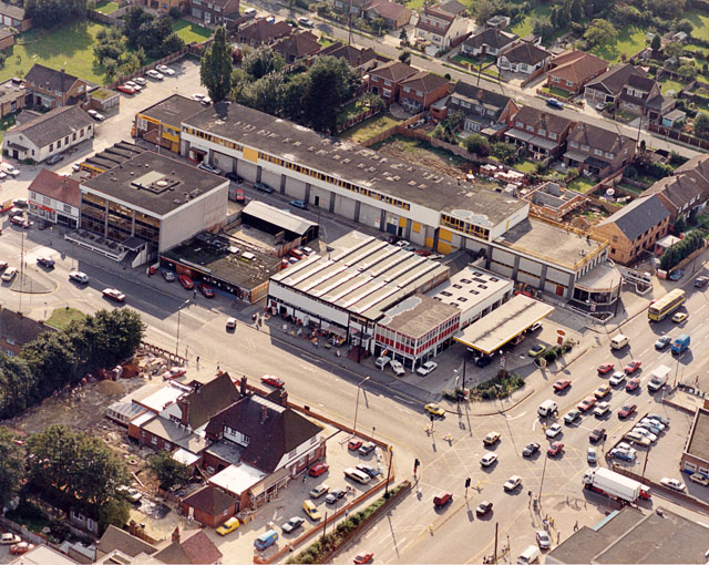
English: Great Tarpots from east south-east. This close-up aerial photo of the Tarpots junction shows the A13 (London Road) across the lower right and the B1006 (High road) towards the left centre. The Harvester pub 1525568 is to the lower left, and Al Harrison's Furniture Kingdom 1525575 stretches along the upper right of centre. |
| Date | |
| Source | From geograph.org.uk |
| Author | Edward Clack |
| Attribution (required by the license) | Edward Clack / Great Tarpots from east south-east / |
| Camera location | | View this and other nearby images on: OpenStreetMap |
|---|
_heading:247.00&language=en)
| Object location | | View this and other nearby images on: OpenStreetMap |
|---|
_heading:247.00&language=en)
Licensing edit

|
This image was taken from the Geograph project collection. See this photograph's page on the Geograph website for the photographer's contact details. The copyright on this image is owned by Edward Clack and is licensed for reuse under the Creative Commons Attribution-ShareAlike 2.0 license.
|
This file is licensed under the Creative Commons Attribution-Share Alike 2.0 Generic license.
Attribution: Edward Clack
- You are free:
- to share – to copy, distribute and transmit the work
- to remix – to adapt the work
- Under the following conditions:
- attribution – You must give appropriate credit, provide a link to the license, and indicate if changes were made. You may do so in any reasonable manner, but not in any way that suggests the licensor endorses you or your use.
- share alike – If you remix, transform, or build upon the material, you must distribute your contributions under the same or compatible license as the original.
File history
Click on a date/time to view the file as it appeared at that time.
| Date/Time | Thumbnail | Dimensions | User | Comment | |
|---|---|---|---|---|---|
| current | 13:19, 3 March 2011 | | 640 × 510 (177 KB) | GeographBot (talk | contribs) | == {{int:filedesc}} == {{Information |description={{en|1=Great Tarpots from east south-east This close-up aerial photo of the Tarpots junction shows the A13 (London Road) across the lower right and the B1006 (High road) towards the left centre. The Harves |
You cannot overwrite this file.
File usage on Commons
There are no pages that use this file.