File:Greater Prague.png

Size of this preview: 800 × 585 pixels. Other resolutions: 320 × 234 pixels | 640 × 468 pixels | 1,024 × 749 pixels | 1,373 × 1,004 pixels.
Original file (1,373 × 1,004 pixels, file size: 90 KB, MIME type: image/png)
Captions
Captions
Add a one-line explanation of what this file represents
| Description |
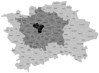
English: Cadastral map of Greater Prague Čeština: Katastrální mapa Velké Prahy |
| Date | (UTC) |
| Source | |
| Author |
|
| This is a retouched picture, which means that it has been digitally altered from its original version. The original can be viewed here: Katastrální mapa Prahy.PNG:
|
I, the copyright holder of this work, hereby publish it under the following license:
| I, the copyright holder of this work, release this work into the public domain. This applies worldwide. In some countries this may not be legally possible; if so: I grant anyone the right to use this work for any purpose, without any conditions, unless such conditions are required by law. |
Original upload log edit
This image is a derivative work of the following images:
- File:Katastrální_mapa_Prahy.PNG licensed with PD-self
- 2011-03-24T17:04:56Z Mapového náložník 1373x1004 (89546 Bytes) {{Information |Description ={{en|1=Cadastral map of Praha}} {{cs|1=Katastrální mapa Prahy}} |Source ={{own}} |Author =[[User:Mapového náložník|Mapového náložník]] |Date =23.3.2011 |Permi
Uploaded with derivativeFX
File history
Click on a date/time to view the file as it appeared at that time.
| Date/Time | Thumbnail | Dimensions | User | Comment | |
|---|---|---|---|---|---|
| current | 08:43, 1 June 2011 | | 1,373 × 1,004 (90 KB) | Fext (talk | contribs) | {{Information |Description={{en|1=Cadastral map of Greater Prague}} {{cs|1=Katastrální mapa Velké Prahy}} |Source=*File:Katastrální_mapa_Prahy.PNG |Date=2011-06-01 08:43 (UTC) |Author=*File:Katastrální_mapa_Prahy.PNG: [[User:Mapového n |
You cannot overwrite this file.
File usage on Commons
There are no pages that use this file.
File usage on other wikis
The following other wikis use this file:
- Usage on cs.wikipedia.org