File:Greatest extent of railways in Ulster.svg

Size of this PNG preview of this SVG file: 707 × 599 pixels. Other resolutions: 283 × 240 pixels | 566 × 480 pixels | 906 × 768 pixels | 1,208 × 1,024 pixels | 2,416 × 2,048 pixels | 716 × 607 pixels.
Original file (SVG file, nominally 716 × 607 pixels, file size: 1.39 MB)
Captions
Captions
Add a one-line explanation of what this file represents
Summary edit
| Description |
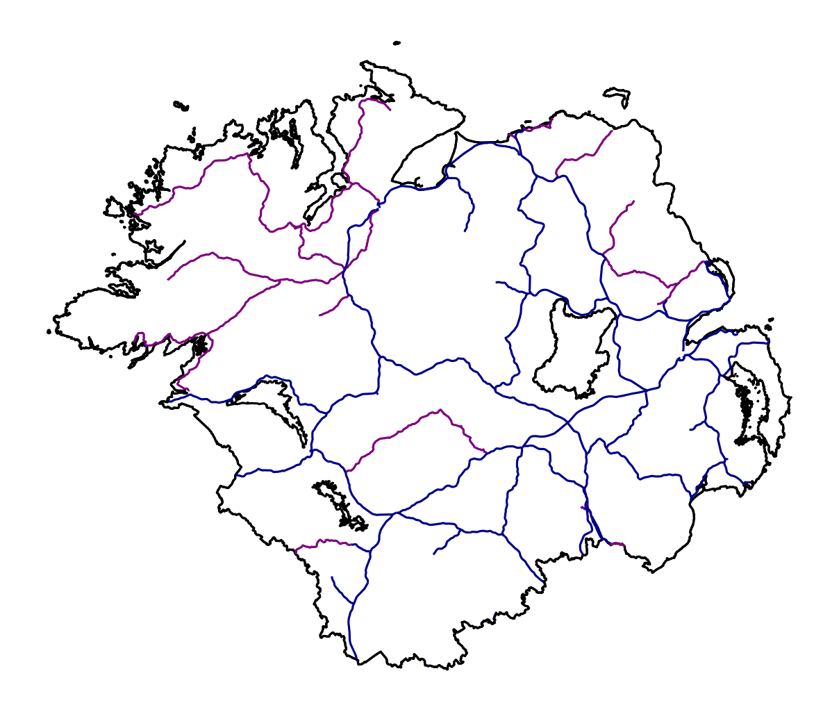
English: A map of the railways of Ulster as they were between 1910 (opening of Keady to Castleblayney line) and 1915 (closure of Warrenpoint to Rostrevor tramway), which was the maximum extent of the network. Blue lines are 1600 mm gauge and purple lines are 914 mm gauge. |
| Date | |
| Source | Own work |
| Author | Madfly2 |
Licensing edit
I, the copyright holder of this work, hereby publish it under the following license:
This file is licensed under the Creative Commons Attribution-Share Alike 4.0 International license.
- You are free:
- to share – to copy, distribute and transmit the work
- to remix – to adapt the work
- Under the following conditions:
- attribution – You must give appropriate credit, provide a link to the license, and indicate if changes were made. You may do so in any reasonable manner, but not in any way that suggests the licensor endorses you or your use.
- share alike – If you remix, transform, or build upon the material, you must distribute your contributions under the same or compatible license as the original.
File history
Click on a date/time to view the file as it appeared at that time.
| Date/Time | Thumbnail | Dimensions | User | Comment | |
|---|---|---|---|---|---|
| current | 10:27, 21 June 2023 | | 716 × 607 (1.39 MB) | Madfly2 (talk | contribs) | Uploaded own work with UploadWizard |
You cannot overwrite this file.
File usage on Commons
The following 3 pages use this file: