File:Greers Ferry Lake, Arkansas LOC 82691818.jpg

Size of this preview: 421 × 599 pixels. Other resolutions: 168 × 240 pixels | 337 × 480 pixels | 539 × 768 pixels | 719 × 1,024 pixels | 1,438 × 2,048 pixels | 7,224 × 10,286 pixels.
Original file (7,224 × 10,286 pixels, file size: 10.23 MB, MIME type: image/jpeg)
Captions
Captions
Add a one-line explanation of what this file represents
Summary edit
| Description |
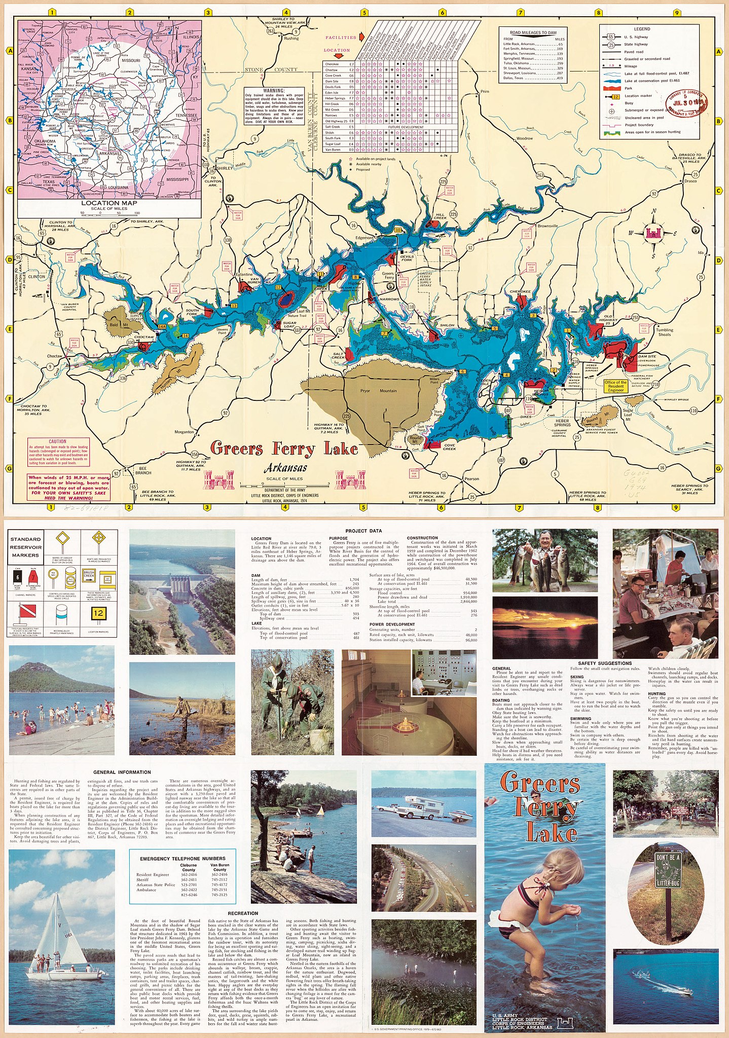
English: Panel title: Greers Ferry Lake. Includes list of distances, index to facilities, and location map. Text, col. ill., emergency telephone numbers, and chart of "Standard reservoir markers" on verso. Available also through the Library of Congress Web site as a raster image. |
||
| Title | Greers Ferry Lake, Arkansas | ||
| Shelf ID | G4002.G69 1974 .U5 | ||
| Date | |||
| Source | https://www.loc.gov/item/82691818/ | ||
| Author | United States. Army. Corps Of Engineers. Little Rock District | ||
| Permission (Reusing this file) |
|
||
| Other versions |
|
||
| Location | Greers Ferry Lake · United States · Arkansas · Greers Ferry Lake. | ||
| Part of | American Memory · General Maps · Catalog · Geography And Map Division | ||
| Subject | Greers Ferry Lake (Ark.) · Maps · Arkansas · Greers Ferry Lake · United States |


Licensing edit
| This work is from the Library of Congress. According to the library, there are no known copyright restrictions on the use of this work. |  |
File history
Click on a date/time to view the file as it appeared at that time.
| Date/Time | Thumbnail | Dimensions | User | Comment | |
|---|---|---|---|---|---|
| current | 07:34, 31 January 2019 | | 7,224 × 10,286 (10.23 MB) | Fæ (talk | contribs) | LOC Maps https://www.loc.gov/item/82691818/ #35312 |
You cannot overwrite this file.
File usage on Commons
The following page uses this file: