File:Grieskirchen - Schloss Parz.JPG
Size of this preview: 800 × 477 pixels. Other resolutions: 320 × 191 pixels | 640 × 382 pixels | 1,024 × 611 pixels | 1,280 × 764 pixels | 2,560 × 1,528 pixels | 3,690 × 2,202 pixels.
Original file (3,690 × 2,202 pixels, file size: 6.77 MB, MIME type: image/jpeg)
Captions
Captions
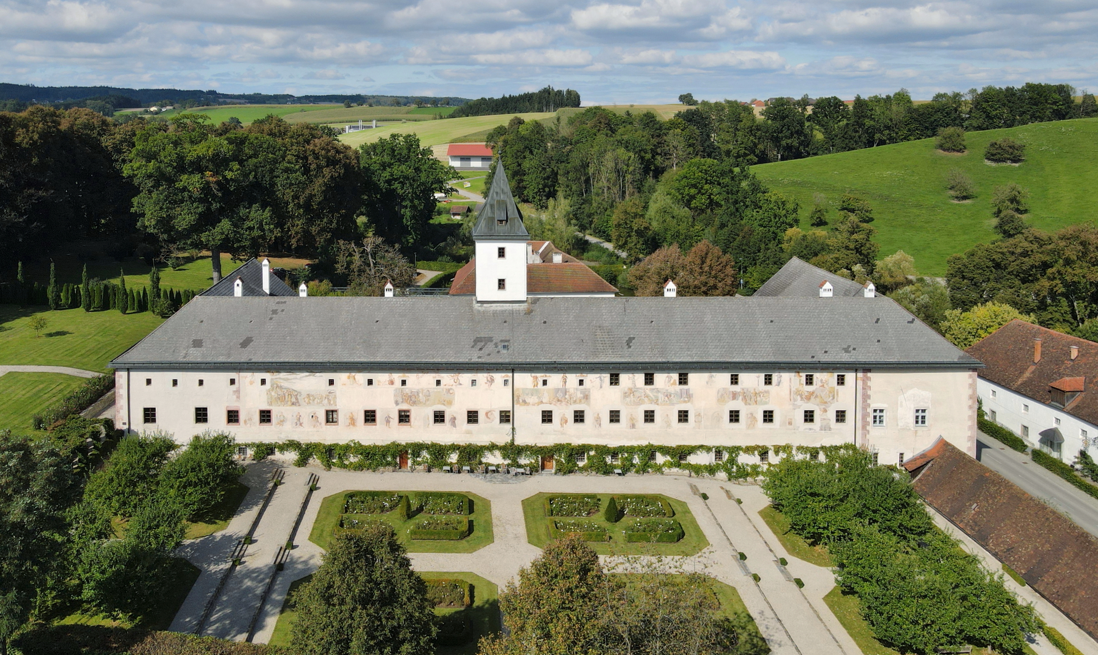
South view of Parz Castle, Upper Austria.
Summary edit
| Description |
Deutsch: Südansicht des (Land)Schlosses Parz in der oberösterreichischen Bezirkshauptstadt Grieskirchen.
Das (Land)Schloss wurde südlich neben dem Wasserschloss im 16. Jahrhundert von den Grafen Pollheim errichtet. Es besteht aus einem dreigeschossigen Haupttrakt mit Turm und zwei kürzeren Seitenflügeln. 1987 entdeckte man an der etwa 100 m langen Südfassade großflächige Fresken, die eine Fläche von nahezu 600 m² bedecken. Sie wurden im Auftrag des Protestanten Sigmund von Pollheim (1531–1598) angefertigt und haben die Überlegenheit des Protestantismus gegenüber dem Katholizismus zum Thema: [1]. Das Wasserschloss war ursprünglich eine kleine mittelalterliche Wasserburg. 1985 erwarb der ÖVP-Politiker Georg Spiegelfeld-Schneeburg das (Land)Schloss Parz und das benachbarte Wasserschloss Parz. Ersteres wurde nach Sanierung und Abhaltung der oberösterreichischen Landesausstellung 2010 an die Messerschmitt-Stiftung verkauft. Zweiteres bot er im Jahr 2010 um 3,2 Mio. Euro zum Kauf an: [2]. English: South view of Parz Castle, Upper Austria. |
| Date | |
| Source | Own work |
| Author | C.Stadler/Bwag |
| Permission (Reusing this file) |
Deutsch: Hallo, du darfst mein Foto kostenlos nutzen, aber nenne mich bitte als Fotograf, beispielsweise „Foto: C.Stadler/Bwag“ oder © C.Stadler/Bwag; CC-BY-SA-4.0. Auf mehr Angaben bestehe ich nicht - im Gegensatz zu manch anderen, die die Vorgaben der unten angeführten Lizenzierung auf Punkt und Beistrich einfordern. English: Feel free to use my photos, but please mention me as the author like © C.Stadler/Bwag or © C.Stadler/Bwag; CC-BY-SA-4.0 (that's good enough) and if you want send me a message: bwag@gmx.net. |
| Other versions |
|
.JPG)
| Object location | | View this and other nearby images on: OpenStreetMap |
|---|
| Camera location | | View this and other nearby images on: OpenStreetMap |
|---|
Licensing edit
I, the copyright holder of this work, hereby publish it under the following license:
This file is licensed under the Creative Commons Attribution-Share Alike 4.0 International license.
- You are free:
- to share – to copy, distribute and transmit the work
- to remix – to adapt the work
- Under the following conditions:
- attribution – You must give appropriate credit, provide a link to the license, and indicate if changes were made. You may do so in any reasonable manner, but not in any way that suggests the licensor endorses you or your use.
- share alike – If you remix, transform, or build upon the material, you must distribute your contributions under the same or compatible license as the original.
File history
Click on a date/time to view the file as it appeared at that time.
| Date/Time | Thumbnail | Dimensions | User | Comment | |
|---|---|---|---|---|---|
| current | 08:08, 22 September 2021 | | 3,690 × 2,202 (6.77 MB) | Bwag (talk | contribs) | wb |
| 20:03, 21 September 2021 |  | 3,700 × 2,207 (7.2 MB) | Bwag (talk | contribs) | == {{int:filedesc}} == {{Information |Description= {{de|1= Südansicht des (Land)Schlosses Parz in der oberösterreichischen Bezirkshauptstadt Grieskirchen.<br/>Das (Land)Schloss wurde südlich neben dem Wasserschloss im 16. Jahrhundert von den Grafen Pollheim errichtet. Es besteht aus einem dreigeschossigen Haupttrakt mit Turm und zwei kürzeren Seitenflügeln. 1987 entdeckte man an der etwa 100 m langen Südfassade großflächige Fresken, die eine Fläche von nahezu 600 m² bedecken. Sie wurden im A... |
You cannot overwrite this file.
File usage on Commons
The following 3 pages use this file:
File usage on other wikis
The following other wikis use this file:
- Usage on de.wikipedia.org
- Usage on it.wikipedia.org
- Usage on www.wikidata.org